Steet Mountain Topo Map Oregon
To zoom in, hover over the map of Steet Mountain
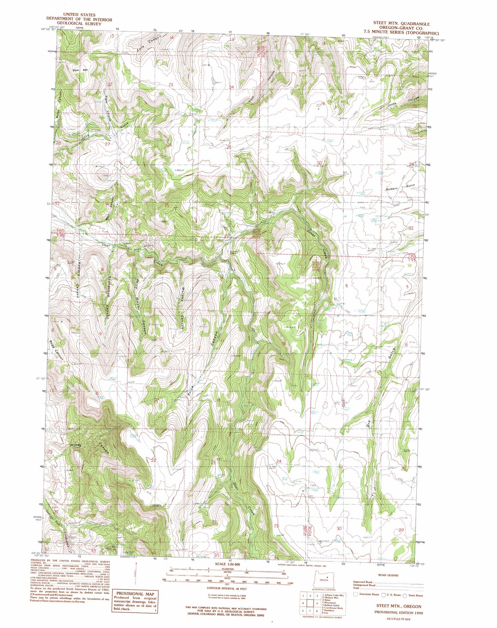
USGS Topo Quad 44119g3 - 1:24,000 scale
| Topo Map Name: | Steet Mountain |
| USGS Topo Quad ID: | 44119g3 |
| Print Size: | ca. 21 1/4" wide x 27" high |
| Southeast Coordinates: | 44.75° N latitude / 119.25° W longitude |
| Map Center Coordinates: | 44.8125° N latitude / 119.3125° W longitude |
| U.S. State: | OR |
| Filename: | o44119g3.jpg |
| Download Map JPG Image: | Steet Mountain topo map 1:24,000 scale |
| Map Type: | Topographic |
| Topo Series: | 7.5´ |
| Map Scale: | 1:24,000 |
| Source of Map Images: | United States Geological Survey (USGS) |
| Alternate Map Versions: |
Steet Mtn. OR 1990, updated 1990 Download PDF Buy paper map Steet Mountain OR 2011 Download PDF Buy paper map Steet Mountain OR 2014 Download PDF Buy paper map |
1:24,000 Topo Quads surrounding Steet Mountain
Big Rock Flat |
Madison Butte |
Lake Penland |
Thompson Flat |
Deerhorn Creek |
Turner Mountain |
Johnny Cake Mountain |
Slickear Mountain |
Ritter |
Meadow Brook Summit |
Bologna Basin |
Monument |
Steet Mountain |
Bullock Gulch |
Flowers Gulch |
Miller Flat |
Courthouse Rock |
Hamilton |
Fox |
Long Creek |
Picture Gorge East |
Sheep Ridge |
Donaldson Creek |
Belshaw Meadows |
Beech Creek Summit |
> Back to 44119e1 at 1:100,000 scale
> Back to 44118a1 at 1:250,000 scale
> Back to U.S. Topo Maps home
Steet Mountain topo map: Gazetteer
Steet Mountain: Springs
Schoolhouse Hill Spring elevation 951m 3120′Steet Mountain: Streams
Jonas Creek elevation 852m 2795′Steet Mountain: Summits
Schoolhouse Hill elevation 1153m 3782′Steet Mountain elevation 1153m 3782′
Steet Mountain: Valleys
Howard Canyon elevation 697m 2286′Mail Canyon elevation 712m 2335′
Murphy Canyon elevation 793m 2601′
Perry Wilson Canyon elevation 739m 2424′
Price Canyon elevation 863m 2831′
Sheepshed Canyon elevation 719m 2358′
Steet Canyon elevation 898m 2946′
Steet Mountain digital topo map on disk
Buy this Steet Mountain topo map showing relief, roads, GPS coordinates and other geographical features, as a high-resolution digital map file on DVD: