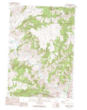
Kimberly Topo Map Oregon
To zoom in, hover over the map of Kimberly
USGS Topo Quad 44119g6 - 1:24,000 scale
| Topo Map Name: | Kimberly |
| USGS Topo Quad ID: | 44119g6 |
| Print Size: | ca. 21 1/4" wide x 27" high |
| Southeast Coordinates: | 44.75° N latitude / 119.625° W longitude |
| Map Center Coordinates: | 44.8125° N latitude / 119.6875° W longitude |
| U.S. State: | OR |
| Filename: | o44119g6.jpg |
| Download Map JPG Image: | Kimberly topo map 1:24,000 scale |
| Map Type: | Topographic |
| Topo Series: | 7.5´ |
| Map Scale: | 1:24,000 |
| Source of Map Images: | United States Geological Survey (USGS) |
| Alternate Map Versions: |
Kimberly OR 1990, updated 1990 Download PDF Buy paper map Kimberly OR 2011 Download PDF Buy paper map Kimberly OR 2014 Download PDF Buy paper map |
| FStopo: | US Forest Service topo Kimberly is available: Download FStopo PDF Download FStopo TIF |
1:24,000 Topo Quads surrounding Kimberly
> Back to 44119e1 at 1:100,000 scale
> Back to 44118a1 at 1:250,000 scale
> Back to U.S. Topo Maps home
Kimberly topo map: Gazetteer
Kimberly: Canals
Potter Ditch elevation 544m 1784′Kimberly: Populated Places
Kimberly elevation 566m 1856′Kimberly: Post Offices
Kimberly Post Office elevation 566m 1856′Spring Valley Post Office (historical) elevation 546m 1791′
Kimberly: Ridges
Long Point elevation 1026m 3366′Kimberly: Springs
Mitchell Spring elevation 864m 2834′White House Spring elevation 1367m 4484′
Kimberly: Streams
Balm Creek elevation 560m 1837′Bologna Creek elevation 553m 1814′
China Hat Creek elevation 719m 2358′
Ives Creek elevation 593m 1945′
North Fork John Day River elevation 559m 1833′
Second Creek elevation 640m 2099′
Third Creek elevation 651m 2135′
Kimberly: Summits
China Hat Peak elevation 933m 3061′Little Tamarack Mountain elevation 1515m 4970′
Tamarack Mountain elevation 1511m 4957′
Kimberly: Trails
Knob Trail elevation 946m 3103′Kimberly: Valleys
East Bologna Canyon elevation 695m 2280′West Bologna Canyon elevation 733m 2404′
Kimberly digital topo map on disk
Buy this Kimberly topo map showing relief, roads, GPS coordinates and other geographical features, as a high-resolution digital map file on DVD:


