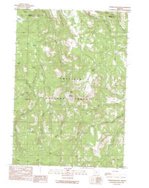
Turner Mountain Topo Map Oregon
To zoom in, hover over the map of Turner Mountain
USGS Topo Quad 44119h5 - 1:24,000 scale
| Topo Map Name: | Turner Mountain |
| USGS Topo Quad ID: | 44119h5 |
| Print Size: | ca. 21 1/4" wide x 27" high |
| Southeast Coordinates: | 44.875° N latitude / 119.5° W longitude |
| Map Center Coordinates: | 44.9375° N latitude / 119.5625° W longitude |
| U.S. State: | OR |
| Filename: | o44119h5.jpg |
| Download Map JPG Image: | Turner Mountain topo map 1:24,000 scale |
| Map Type: | Topographic |
| Topo Series: | 7.5´ |
| Map Scale: | 1:24,000 |
| Source of Map Images: | United States Geological Survey (USGS) |
| Alternate Map Versions: |
Turner Mountain OR 1990, updated 1990 Download PDF Buy paper map Turner Mountain OR 1995, updated 1998 Download PDF Buy paper map Turner Mountain OR 2011 Download PDF Buy paper map Turner Mountain OR 2014 Download PDF Buy paper map |
| FStopo: | US Forest Service topo Turner Mountain is available: Download FStopo PDF Download FStopo TIF |
1:24,000 Topo Quads surrounding Turner Mountain
> Back to 44119e1 at 1:100,000 scale
> Back to 44118a1 at 1:250,000 scale
> Back to U.S. Topo Maps home
Turner Mountain topo map: Gazetteer
Turner Mountain: Ridges
Happy Jack Ridge elevation 1452m 4763′Turner Mountain: Springs
Bell Spring elevation 1287m 4222′Big Burn Spring elevation 1105m 3625′
Big Cat Spring elevation 1171m 3841′
Big Willow Spring elevation 1122m 3681′
Brown Spring elevation 1221m 4005′
CCC Spring elevation 1366m 4481′
Happy Jack Spring elevation 1318m 4324′
Kingbolt Spring elevation 1148m 3766′
Snowshoe Spring elevation 1256m 4120′
Sunflower Spring elevation 1259m 4130′
Three Spring elevation 1391m 4563′
Willow Spring elevation 1292m 4238′
Turner Mountain: Streams
Big Willow Spring Creek elevation 825m 2706′Grassy Butte Creek elevation 997m 3270′
Happy Jack Creek elevation 884m 2900′
Harrington Creek elevation 1075m 3526′
Little Wilson Creek elevation 855m 2805′
South Fork Big Wall Creek elevation 1012m 3320′
Three Trough Creek elevation 959m 3146′
Willow Spring Creek elevation 953m 3126′
Wilson Creek elevation 900m 2952′
Turner Mountain: Summits
China Cap elevation 1042m 3418′Eagle Rock elevation 1048m 3438′
Turner Mountain elevation 1251m 4104′
Wild Horse Butte elevation 1199m 3933′
Turner Mountain: Valleys
Cat Canyon elevation 999m 3277′Dark Canyon elevation 960m 3149′
Lost Canyon elevation 926m 3038′
Rough Canyon elevation 1003m 3290′
Turner Mountain digital topo map on disk
Buy this Turner Mountain topo map showing relief, roads, GPS coordinates and other geographical features, as a high-resolution digital map file on DVD:


