Collins Butte Topo Map Oregon
To zoom in, hover over the map of Collins Butte
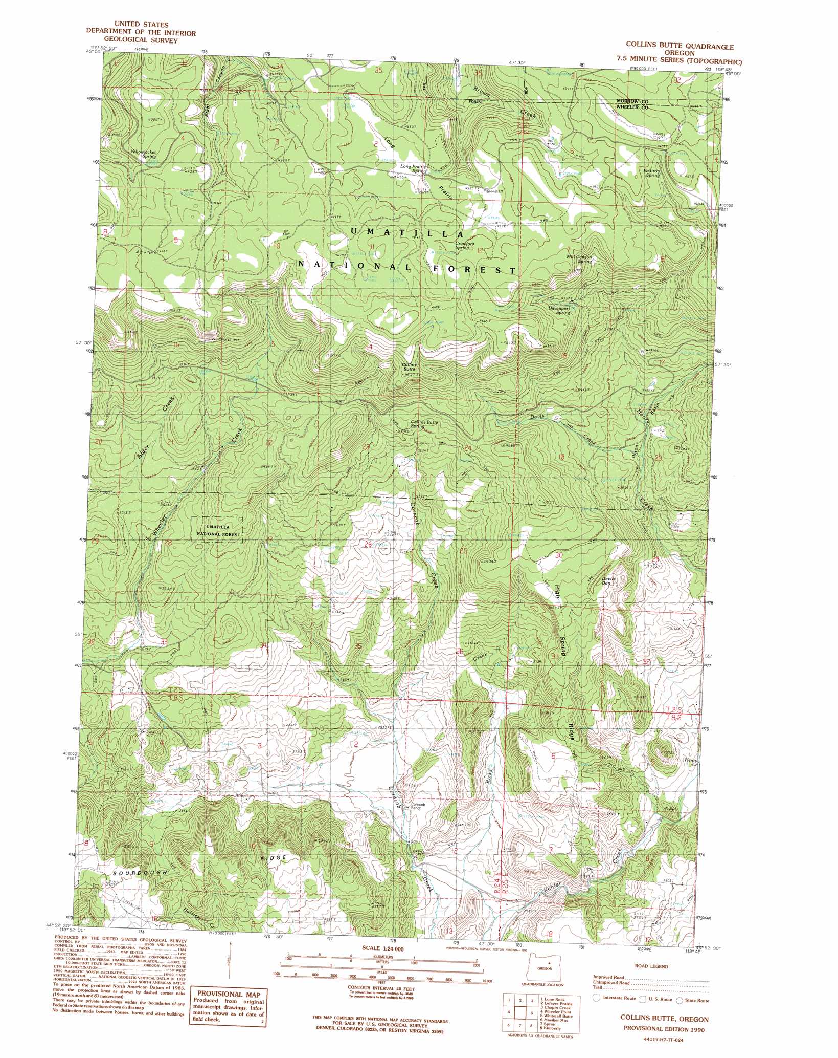
USGS Topo Quad 44119h7 - 1:24,000 scale
| Topo Map Name: | Collins Butte |
| USGS Topo Quad ID: | 44119h7 |
| Print Size: | ca. 21 1/4" wide x 27" high |
| Southeast Coordinates: | 44.875° N latitude / 119.75° W longitude |
| Map Center Coordinates: | 44.9375° N latitude / 119.8125° W longitude |
| U.S. State: | OR |
| Filename: | o44119h7.jpg |
| Download Map JPG Image: | Collins Butte topo map 1:24,000 scale |
| Map Type: | Topographic |
| Topo Series: | 7.5´ |
| Map Scale: | 1:24,000 |
| Source of Map Images: | United States Geological Survey (USGS) |
| Alternate Map Versions: |
Collins Butte OR 1990, updated 1990 Download PDF Buy paper map Collins Butte OR 1995, updated 1998 Download PDF Buy paper map Collins Butte OR 2011 Download PDF Buy paper map Collins Butte OR 2014 Download PDF Buy paper map |
| FStopo: | US Forest Service topo Collins Butte is available: Download FStopo PDF Download FStopo TIF |
1:24,000 Topo Quads surrounding Collins Butte
Matney Flat |
Lone Rock Creek |
Buttermilk Canyon |
Hardman |
Balm Canyon |
Salmon Fork |
Lonerock |
Lefevre Prairie |
Chapin Creek |
Big Rock Flat |
Kinzua |
Wheeler Point |
Collins Butte |
Whitetail Butte |
Turner Mountain |
Service Creek |
Massacre Mountain |
Spray |
Kimberly |
Bologna Basin |
Toney Butte |
Richmond |
Johnson Heights |
Mount Misery |
Miller Flat |
> Back to 44119e1 at 1:100,000 scale
> Back to 44118a1 at 1:250,000 scale
> Back to U.S. Topo Maps home
Collins Butte topo map: Gazetteer
Collins Butte: Flats
Devils Den elevation 1137m 3730′Long Prairie elevation 1391m 4563′
Collins Butte: Reservoirs
Aspen Reservoir elevation 1398m 4586′Long Prairie Reservoir elevation 1406m 4612′
Collins Butte: Ridges
High Spring Ridge elevation 1028m 3372′Collins Butte: Springs
Collins Butte Spring elevation 1177m 3861′Crawford Spring elevation 1399m 4589′
Davenport Spring elevation 1294m 4245′
Flatiron Spring elevation 1378m 4520′
Hill Spring elevation 856m 2808′
Long Prairie Spring elevation 1391m 4563′
Mill Canyon Spring elevation 1327m 4353′
Yellowjacket Spring elevation 1428m 4685′
Collins Butte: Streams
Crawford Creek elevation 1221m 4005′Davis Creek elevation 1020m 3346′
Henry Creek elevation 755m 2477′
Ricks Creek elevation 654m 2145′
Collins Butte: Summits
Collins Butte elevation 1470m 4822′Collins Butte: Valleys
Dixon Basin elevation 1030m 3379′Collins Butte digital topo map on disk
Buy this Collins Butte topo map showing relief, roads, GPS coordinates and other geographical features, as a high-resolution digital map file on DVD: