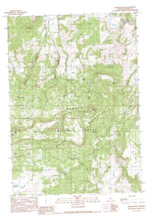
Drake Butte Topo Map Oregon
To zoom in, hover over the map of Drake Butte
USGS Topo Quad 44120a3 - 1:24,000 scale
| Topo Map Name: | Drake Butte |
| USGS Topo Quad ID: | 44120a3 |
| Print Size: | ca. 21 1/4" wide x 27" high |
| Southeast Coordinates: | 44° N latitude / 120.25° W longitude |
| Map Center Coordinates: | 44.0625° N latitude / 120.3125° W longitude |
| U.S. State: | OR |
| Filename: | o44120a3.jpg |
| Download Map JPG Image: | Drake Butte topo map 1:24,000 scale |
| Map Type: | Topographic |
| Topo Series: | 7.5´ |
| Map Scale: | 1:24,000 |
| Source of Map Images: | United States Geological Survey (USGS) |
| Alternate Map Versions: |
Drake Butte OR 1990, updated 1990 Download PDF Buy paper map Drake Butte OR 1992, updated 1997 Download PDF Buy paper map Drake Butte OR 2011 Download PDF Buy paper map Drake Butte OR 2014 Download PDF Buy paper map |
| FStopo: | US Forest Service topo Drake Butte is available: Download FStopo PDF Download FStopo TIF |
1:24,000 Topo Quads surrounding Drake Butte
> Back to 44120a1 at 1:100,000 scale
> Back to 44120a1 at 1:250,000 scale
> Back to U.S. Topo Maps home
Drake Butte topo map: Gazetteer
Drake Butte: Flats
Antelope Flat elevation 1519m 4983′Telephone Flat elevation 1599m 5246′
Wiley Flat elevation 1612m 5288′
Drake Butte: Lakes
Double Cabin Pond elevation 1571m 5154′Miller Lake elevation 1420m 4658′
Drake Butte: Reservoirs
Frank Reservoir elevation 1317m 4320′Peterson Reservoir elevation 1295m 4248′
Reams Reservoir elevation 1359m 4458′
Drake Butte: Springs
CCC Spring elevation 1444m 4737′Coyote Spring elevation 1497m 4911′
Drake Spring elevation 1764m 5787′
East Shotgun Spring elevation 1644m 5393′
Hillside Spring elevation 1521m 4990′
J F Spring elevation 1551m 5088′
Soap Spring elevation 1508m 4947′
Tom Vawn Spring elevation 1505m 4937′
West Shotgun Spring elevation 1536m 5039′
Drake Butte: Streams
Double Cabin Creek elevation 1364m 4475′Drake Creek elevation 1038m 3405′
Shotgun Creek elevation 1076m 3530′
Tom Vawn Creek elevation 1058m 3471′
Wildcat Creek elevation 1040m 3412′
Wiley Creek elevation 1378m 4520′
Drake Butte: Summits
Drake Butte elevation 1901m 6236′Polk Butte elevation 1252m 4107′
Tower Point elevation 1858m 6095′
Drake Butte digital topo map on disk
Buy this Drake Butte topo map showing relief, roads, GPS coordinates and other geographical features, as a high-resolution digital map file on DVD:


