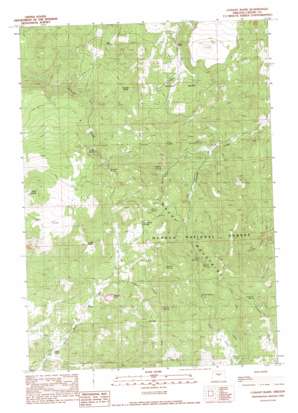
Conant Basin Topo Map Oregon
To zoom in, hover over the map of Conant Basin
USGS Topo Quad 44120a5 - 1:24,000 scale
| Topo Map Name: | Conant Basin |
| USGS Topo Quad ID: | 44120a5 |
| Print Size: | ca. 21 1/4" wide x 27" high |
| Southeast Coordinates: | 44° N latitude / 120.5° W longitude |
| Map Center Coordinates: | 44.0625° N latitude / 120.5625° W longitude |
| U.S. State: | OR |
| Filename: | o44120a5.jpg |
| Download Map JPG Image: | Conant Basin topo map 1:24,000 scale |
| Map Type: | Topographic |
| Topo Series: | 7.5´ |
| Map Scale: | 1:24,000 |
| Source of Map Images: | United States Geological Survey (USGS) |
| Alternate Map Versions: |
Conant Basin OR 1990, updated 1990 Download PDF Buy paper map Conant Basin OR 1992, updated 1997 Download PDF Buy paper map Conant Basin OR 2011 Download PDF Buy paper map Conant Basin OR 2014 Download PDF Buy paper map |
| FStopo: | US Forest Service topo Conant Basin is available: Download FStopo PDF Download FStopo TIF |
1:24,000 Topo Quads surrounding Conant Basin
> Back to 44120a1 at 1:100,000 scale
> Back to 44120a1 at 1:250,000 scale
> Back to U.S. Topo Maps home
Conant Basin topo map: Gazetteer
Conant Basin: Basins
Conant Basin elevation 1294m 4245′Conant Basin: Cliffs
Juniper Point elevation 1261m 4137′Conant Basin: Gaps
Newsome Saddle elevation 1568m 5144′Conant Basin: Springs
Blue Eagle Spring elevation 1672m 5485′Bobcat Spring elevation 1425m 4675′
Colby Spring elevation 1435m 4708′
Cox Spring elevation 1598m 5242′
Ferguson Spring elevation 1672m 5485′
Gibson Spring elevation 1494m 4901′
Hamer Spring elevation 1567m 5141′
Mud Spring elevation 1419m 4655′
Rambo Spring elevation 1604m 5262′
Sanford Spring elevation 1528m 5013′
Skelton Spring elevation 1645m 5396′
Sunny Slope Springs elevation 1310m 4297′
Swamp Spring elevation 1640m 5380′
Conant Basin: Streams
Gibson Creek elevation 1280m 4199′Hamer Creek elevation 1749m 5738′
Conant Basin: Summits
Coyote Butte elevation 1512m 4960′Sheep Rock elevation 1558m 5111′
Conant Basin digital topo map on disk
Buy this Conant Basin topo map showing relief, roads, GPS coordinates and other geographical features, as a high-resolution digital map file on DVD:


