Bowman Dam Topo Map Oregon
To zoom in, hover over the map of Bowman Dam
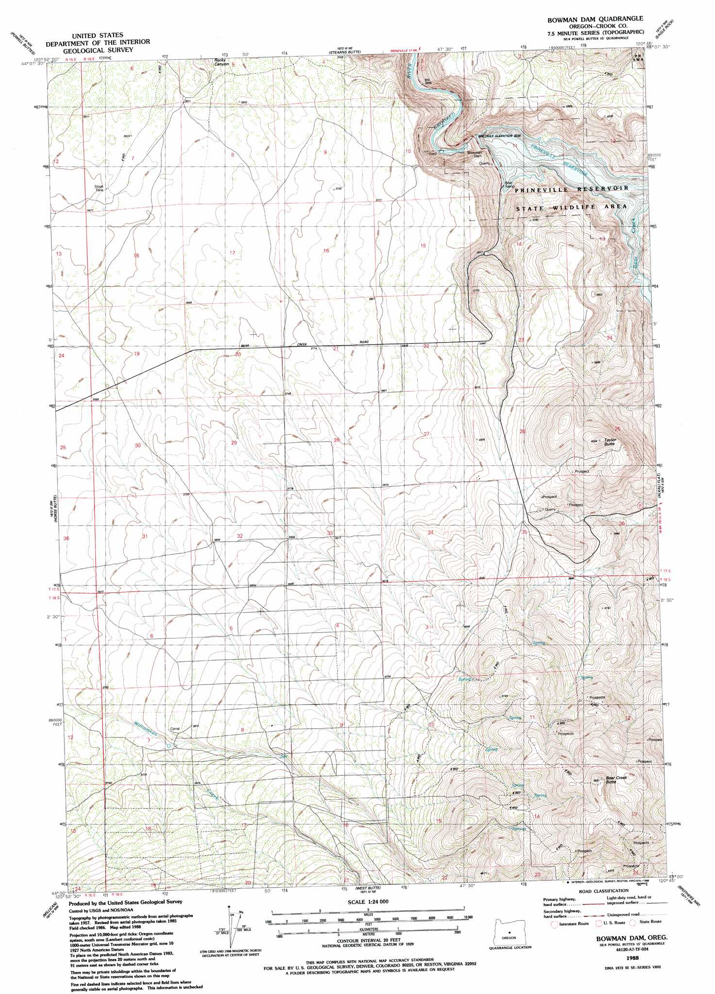
USGS Topo Quad 44120a7 - 1:24,000 scale
| Topo Map Name: | Bowman Dam |
| USGS Topo Quad ID: | 44120a7 |
| Print Size: | ca. 21 1/4" wide x 27" high |
| Southeast Coordinates: | 44° N latitude / 120.75° W longitude |
| Map Center Coordinates: | 44.0625° N latitude / 120.8125° W longitude |
| U.S. State: | OR |
| Filename: | o44120a7.jpg |
| Download Map JPG Image: | Bowman Dam topo map 1:24,000 scale |
| Map Type: | Topographic |
| Topo Series: | 7.5´ |
| Map Scale: | 1:24,000 |
| Source of Map Images: | United States Geological Survey (USGS) |
| Alternate Map Versions: |
Bowman Dam OR 1988, updated 1988 Download PDF Buy paper map Bowman Dam OR 2011 Download PDF Buy paper map Bowman Dam OR 2014 Download PDF Buy paper map |
1:24,000 Topo Quads surrounding Bowman Dam
O'Neil |
Houston Lake |
Prineville |
Ochoco Reservoir |
Cadle Butte |
Powell Butte |
Powell Buttes |
Stearns Butte |
Eagle Rock |
Pilot Butte |
Alfalfa |
Horse Butte |
Bowman Dam |
Alkali Flat |
Conant Basin |
Horse Ridge |
Millican |
West Butte |
Rodman Ridge |
Sugarloaf Butte |
Evans Well |
Pine Mountain |
Millican Se |
Brothers Sw |
Brothers |
> Back to 44120a1 at 1:100,000 scale
> Back to 44120a1 at 1:250,000 scale
> Back to U.S. Topo Maps home
Bowman Dam topo map: Gazetteer
Bowman Dam: Bays
Powder House Cove elevation 993m 3257′Bowman Dam: Dams
Bowman Dam elevation 1000m 3280′Bowman Dam: Mines
Bear Creek Agate Beds elevation 1170m 3838′Bowman Dam: Reservoirs
Prineville Reservoir elevation 996m 3267′Bowman Dam: Streams
Bear Creek elevation 987m 3238′Perry Creek elevation 1153m 3782′
Bowman Dam: Summits
Bear Creek Butte elevation 1681m 5515′Taylor Butte elevation 1411m 4629′
Bowman Dam digital topo map on disk
Buy this Bowman Dam topo map showing relief, roads, GPS coordinates and other geographical features, as a high-resolution digital map file on DVD: