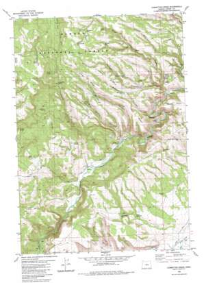
Committee Creek Topo Map Oregon
To zoom in, hover over the map of Committee Creek
USGS Topo Quad 44120b2 - 1:24,000 scale
| Topo Map Name: | Committee Creek |
| USGS Topo Quad ID: | 44120b2 |
| Print Size: | ca. 21 1/4" wide x 27" high |
| Southeast Coordinates: | 44.125° N latitude / 120.125° W longitude |
| Map Center Coordinates: | 44.1875° N latitude / 120.1875° W longitude |
| U.S. State: | OR |
| Filename: | o44120b2.jpg |
| Download Map JPG Image: | Committee Creek topo map 1:24,000 scale |
| Map Type: | Topographic |
| Topo Series: | 7.5´ |
| Map Scale: | 1:24,000 |
| Source of Map Images: | United States Geological Survey (USGS) |
| Alternate Map Versions: |
Committee Creek OR 1983, updated 1983 Download PDF Buy paper map Committee Creek OR 1992, updated 1997 Download PDF Buy paper map Committee Creek OR 2011 Download PDF Buy paper map Committee Creek OR 2014 Download PDF Buy paper map |
| FStopo: | US Forest Service topo Committee Creek is available: Download FStopo PDF Download FStopo TIF |
1:24,000 Topo Quads surrounding Committee Creek
> Back to 44120a1 at 1:100,000 scale
> Back to 44120a1 at 1:250,000 scale
> Back to U.S. Topo Maps home
Committee Creek topo map: Gazetteer
Committee Creek: Falls
Lower Falls elevation 1185m 3887′Committee Creek: Reservoirs
Boundary Reservoir elevation 1551m 5088′Boundary Reservoir elevation 1376m 4514′
Fly Reservoir elevation 1581m 5187′
Gate One Reservoir elevation 1165m 3822′
Hole-in-the-Ground Reservoir elevation 1326m 4350′
Juniper Canyon Reservoir elevation 1403m 4603′
Little Juniper Reservoir elevation 1362m 4468′
Lutsey Reservoir elevation 1596m 5236′
Mudhole Reservoir elevation 1524m 5000′
Old Faithful Reservoir elevation 1188m 3897′
Partnership Reservoir elevation 1288m 4225′
Rimrock Reservoir elevation 1505m 4937′
Tohatin Reservoir elevation 1540m 5052′
Committee Creek: Ridges
Battle Point elevation 1345m 4412′Funeral Ridge elevation 1523m 4996′
Long Ridge elevation 1428m 4685′
Committee Creek: Springs
Basin Spring elevation 1258m 4127′Booton Spring elevation 1668m 5472′
Brummer Springs elevation 1449m 4753′
Cabin Spring elevation 1339m 4393′
Cherry Spring elevation 1279m 4196′
Committee Spring elevation 1476m 4842′
Federal Spring elevation 1275m 4183′
Juniper Spring elevation 1544m 5065′
Lone Pine Spring elevation 1173m 3848′
Mud Spring elevation 1427m 4681′
Rough Spring elevation 1463m 4799′
Teater Spring elevation 1546m 5072′
Telephone Springs elevation 1464m 4803′
Veason Spring elevation 1277m 4189′
Committee Creek: Streams
Committee Creek elevation 1128m 3700′Hail Creek elevation 1227m 4025′
Rough Canyon Creek elevation 1208m 3963′
Swamp Creek elevation 1121m 3677′
Watson Creek elevation 1081m 3546′
Committee Creek: Summits
Cabin Butte elevation 1355m 4445′Committee Creek: Valleys
Bracket Canyon elevation 1231m 4038′Juniper Canyon elevation 1265m 4150′
Mud Spring Canyon elevation 1160m 3805′
Oscar Canyon elevation 1156m 3792′
Rough Canyon elevation 1128m 3700′
Committee Creek digital topo map on disk
Buy this Committee Creek topo map showing relief, roads, GPS coordinates and other geographical features, as a high-resolution digital map file on DVD:


