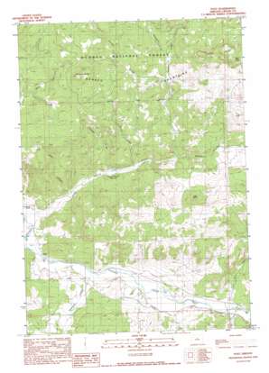
Post Topo Map Oregon
To zoom in, hover over the map of Post
USGS Topo Quad 44120b4 - 1:24,000 scale
| Topo Map Name: | Post |
| USGS Topo Quad ID: | 44120b4 |
| Print Size: | ca. 21 1/4" wide x 27" high |
| Southeast Coordinates: | 44.125° N latitude / 120.375° W longitude |
| Map Center Coordinates: | 44.1875° N latitude / 120.4375° W longitude |
| U.S. State: | OR |
| Filename: | o44120b4.jpg |
| Download Map JPG Image: | Post topo map 1:24,000 scale |
| Map Type: | Topographic |
| Topo Series: | 7.5´ |
| Map Scale: | 1:24,000 |
| Source of Map Images: | United States Geological Survey (USGS) |
| Alternate Map Versions: |
Post OR 1990, updated 1990 Download PDF Buy paper map Post OR 1992, updated 1997 Download PDF Buy paper map Post OR 2011 Download PDF Buy paper map Post OR 2014 Download PDF Buy paper map |
| FStopo: | US Forest Service topo Post is available: Download FStopo PDF Download FStopo TIF |
1:24,000 Topo Quads surrounding Post
> Back to 44120a1 at 1:100,000 scale
> Back to 44120a1 at 1:250,000 scale
> Back to U.S. Topo Maps home
Post topo map: Gazetteer
Post: Dams
Bonnieview Dam elevation 1079m 3540′Post: Gaps
Kelly Gap elevation 1569m 5147′Post: Populated Places
Post elevation 1031m 3382′Post: Post Offices
Post Post Office elevation 1031m 3382′Post: Reservoirs
Horse Heaven Reservoir elevation 1075m 3526′Shoun Reservoir elevation 1033m 3389′
Post: Springs
Lava Point Spring elevation 1224m 4015′Post: Streams
Brown Creek elevation 1080m 3543′Hide Canyon elevation 1036m 3398′
Horse Heaven Creek elevation 1010m 3313′
Meadow Branch elevation 1148m 3766′
Newsome Creek elevation 1014m 3326′
Pine Creek elevation 1032m 3385′
Pine Stub Creek elevation 1035m 3395′
Pringle Creek elevation 1219m 3999′
Tamarack Creek elevation 1223m 4012′
Post: Summits
Joe Butte elevation 1369m 4491′Lucky Butte elevation 1646m 5400′
Pollard Butte elevation 1567m 5141′
Post: Valleys
Pringle Gulch elevation 1061m 3480′Post digital topo map on disk
Buy this Post topo map showing relief, roads, GPS coordinates and other geographical features, as a high-resolution digital map file on DVD:


