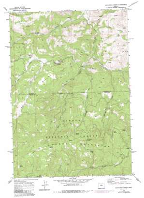
Dutchman Creek Topo Map Oregon
To zoom in, hover over the map of Dutchman Creek
USGS Topo Quad 44120e6 - 1:24,000 scale
| Topo Map Name: | Dutchman Creek |
| USGS Topo Quad ID: | 44120e6 |
| Print Size: | ca. 21 1/4" wide x 27" high |
| Southeast Coordinates: | 44.5° N latitude / 120.625° W longitude |
| Map Center Coordinates: | 44.5625° N latitude / 120.6875° W longitude |
| U.S. State: | OR |
| Filename: | o44120e6.jpg |
| Download Map JPG Image: | Dutchman Creek topo map 1:24,000 scale |
| Map Type: | Topographic |
| Topo Series: | 7.5´ |
| Map Scale: | 1:24,000 |
| Source of Map Images: | United States Geological Survey (USGS) |
| Alternate Map Versions: |
Dutchman Creek OR 1968, updated 1972 Download PDF Buy paper map Dutchman Creek OR 1968, updated 1985 Download PDF Buy paper map Dutchman Creek OR 1992, updated 1997 Download PDF Buy paper map Dutchman Creek OR 2011 Download PDF Buy paper map Dutchman Creek OR 2014 Download PDF Buy paper map |
| FStopo: | US Forest Service topo Dutchman Creek is available: Download FStopo PDF Download FStopo TIF |
1:24,000 Topo Quads surrounding Dutchman Creek
> Back to 44120e1 at 1:100,000 scale
> Back to 44120a1 at 1:250,000 scale
> Back to U.S. Topo Maps home
Dutchman Creek topo map: Gazetteer
Dutchman Creek: Flats
Boxcar Flats elevation 1310m 4297′Highland Flat elevation 1669m 5475′
Dutchman Creek: Gaps
McKay Saddle elevation 1541m 5055′Dutchman Creek: Springs
Aldrich Spring elevation 1505m 4937′Angus Spring elevation 1452m 4763′
Curtis Spring elevation 1614m 5295′
Cyrus Spring elevation 1523m 4996′
Dutchman Spring elevation 1427m 4681′
Hunt Spring elevation 1524m 5000′
Ochillee Spring elevation 1392m 4566′
Ruth Spring elevation 1533m 5029′
Upper Ray Spring elevation 1567m 5141′
Dutchman Creek: Streams
Barber Creek elevation 1187m 3894′Big Log Creek elevation 1009m 3310′
Cartwright Creek elevation 1012m 3320′
Dutchman Creek elevation 1011m 3316′
Foley Creek elevation 976m 3202′
Martin Creek elevation 1178m 3864′
Studhorse Creek elevation 935m 3067′
Dutchman Creek: Summits
Cat Mountain elevation 1230m 4035′Dutchman Creek: Valleys
Board Hollow elevation 913m 2995′Poison Hollow elevation 953m 3126′
Dutchman Creek digital topo map on disk
Buy this Dutchman Creek topo map showing relief, roads, GPS coordinates and other geographical features, as a high-resolution digital map file on DVD:


