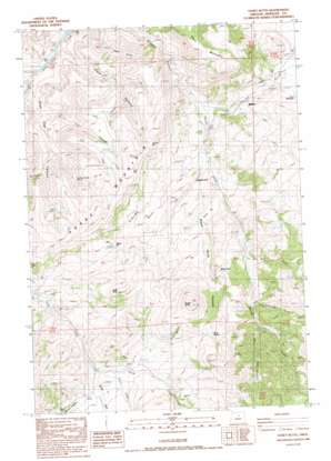
Toney Butte Topo Map Oregon
To zoom in, hover over the map of Toney Butte
USGS Topo Quad 44120f1 - 1:24,000 scale
| Topo Map Name: | Toney Butte |
| USGS Topo Quad ID: | 44120f1 |
| Print Size: | ca. 21 1/4" wide x 27" high |
| Southeast Coordinates: | 44.625° N latitude / 120° W longitude |
| Map Center Coordinates: | 44.6875° N latitude / 120.0625° W longitude |
| U.S. State: | OR |
| Filename: | o44120f1.jpg |
| Download Map JPG Image: | Toney Butte topo map 1:24,000 scale |
| Map Type: | Topographic |
| Topo Series: | 7.5´ |
| Map Scale: | 1:24,000 |
| Source of Map Images: | United States Geological Survey (USGS) |
| Alternate Map Versions: |
Toney Butte OR 1988, updated 1988 Download PDF Buy paper map Toney Butte OR 2011 Download PDF Buy paper map Toney Butte OR 2014 Download PDF Buy paper map |
1:24,000 Topo Quads surrounding Toney Butte
> Back to 44120e1 at 1:100,000 scale
> Back to 44120a1 at 1:250,000 scale
> Back to U.S. Topo Maps home
Toney Butte topo map: Gazetteer
Toney Butte: Cliffs
The Blue Banks elevation 914m 2998′Toney Butte: Flats
Gordy Flat elevation 903m 2962′Toney Butte: Gaps
Bald Gap elevation 1199m 3933′Juniper Gap elevation 1116m 3661′
Toney Butte: Pillars
Black Rock elevation 1124m 3687′Toney Butte: Populated Places
Waldron (historical) elevation 846m 2775′Toney Butte: Post Offices
Waldron Post Office (historical) elevation 846m 2775′Wheeler Post Office (historical) elevation 1042m 3418′
Toney Butte: Reservoirs
Keys Reservoir elevation 961m 3152′Toney Butte: Springs
May Spring elevation 993m 3257′Quaking Aspen Spring elevation 960m 3149′
Rock Spring elevation 1278m 4192′
Toney Butte: Streams
Limekiln Creek elevation 1085m 3559′Melvina Creek elevation 826m 2709′
Monroe Creek elevation 1039m 3408′
Payne Creek elevation 1043m 3421′
Rattlesnake Creek elevation 1056m 3464′
Red Mud Creek elevation 964m 3162′
Tamarack Creek elevation 749m 2457′
Trent Creek elevation 905m 2969′
Toney Butte: Summits
Camel Hump elevation 1096m 3595′Horse Mountain elevation 1188m 3897′
Keys Mountain elevation 1059m 3474′
Mabe Hill elevation 1089m 3572′
Scott Butte elevation 1295m 4248′
Toney Butte elevation 1550m 5085′
Toney Butte: Valleys
Black Rock Canyon elevation 820m 2690′Clark Canyon elevation 499m 1637′
Dead Dog Canyon elevation 507m 1663′
Green Hollow elevation 1085m 3559′
Tilley Canyon elevation 850m 2788′
Trail Canyon elevation 667m 2188′
Toney Butte digital topo map on disk
Buy this Toney Butte topo map showing relief, roads, GPS coordinates and other geographical features, as a high-resolution digital map file on DVD:


