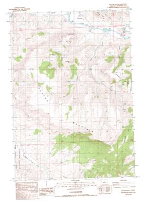
Sutton Mountain Topo Map Oregon
To zoom in, hover over the map of Sutton Mountain
USGS Topo Quad 44120f2 - 1:24,000 scale
| Topo Map Name: | Sutton Mountain |
| USGS Topo Quad ID: | 44120f2 |
| Print Size: | ca. 21 1/4" wide x 27" high |
| Southeast Coordinates: | 44.625° N latitude / 120.125° W longitude |
| Map Center Coordinates: | 44.6875° N latitude / 120.1875° W longitude |
| U.S. State: | OR |
| Filename: | o44120f2.jpg |
| Download Map JPG Image: | Sutton Mountain topo map 1:24,000 scale |
| Map Type: | Topographic |
| Topo Series: | 7.5´ |
| Map Scale: | 1:24,000 |
| Source of Map Images: | United States Geological Survey (USGS) |
| Alternate Map Versions: |
Sutton Mtn. OR 1987, updated 1988 Download PDF Buy paper map Sutton Mountain OR 2011 Download PDF Buy paper map Sutton Mountain OR 2014 Download PDF Buy paper map |
1:24,000 Topo Quads surrounding Sutton Mountain
> Back to 44120e1 at 1:100,000 scale
> Back to 44120a1 at 1:250,000 scale
> Back to U.S. Topo Maps home
Sutton Mountain topo map: Gazetteer
Sutton Mountain: Airports
Collins Landing Strip elevation 467m 1532′Sutton Mountain: Populated Places
Twickenham (historical) elevation 476m 1561′Sutton Mountain: Post Offices
Twickenham Post Office (historical) elevation 476m 1561′Sutton Mountain: Ridges
Goose Paint elevation 588m 1929′Sutton Mountain elevation 1149m 3769′
Sutton Mountain: Springs
Chapman Spring elevation 886m 2906′Sutton Mountain: Streams
Girds Creek elevation 473m 1551′Sutton Mountain: Summits
Packsaddle Mountain elevation 1055m 3461′Rocky Top elevation 547m 1794′
Sutton Mountain: Valleys
Big Canyon elevation 477m 1564′Black Canyon elevation 641m 2103′
Gilchrist Valley elevation 1114m 3654′
James Canyon elevation 487m 1597′
Sutton Mountain digital topo map on disk
Buy this Sutton Mountain topo map showing relief, roads, GPS coordinates and other geographical features, as a high-resolution digital map file on DVD:


