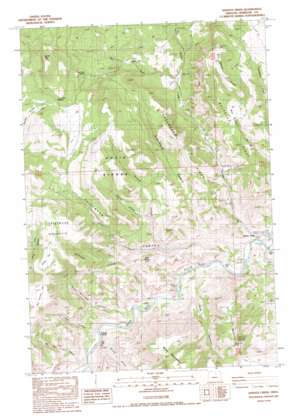
Service Creek Topo Map Oregon
To zoom in, hover over the map of Service Creek
USGS Topo Quad 44120g1 - 1:24,000 scale
| Topo Map Name: | Service Creek |
| USGS Topo Quad ID: | 44120g1 |
| Print Size: | ca. 21 1/4" wide x 27" high |
| Southeast Coordinates: | 44.75° N latitude / 120° W longitude |
| Map Center Coordinates: | 44.8125° N latitude / 120.0625° W longitude |
| U.S. State: | OR |
| Filename: | o44120g1.jpg |
| Download Map JPG Image: | Service Creek topo map 1:24,000 scale |
| Map Type: | Topographic |
| Topo Series: | 7.5´ |
| Map Scale: | 1:24,000 |
| Source of Map Images: | United States Geological Survey (USGS) |
| Alternate Map Versions: |
Service Creek OR 1987, updated 1988 Download PDF Buy paper map Service Creek OR 2011 Download PDF Buy paper map Service Creek OR 2014 Download PDF Buy paper map |
1:24,000 Topo Quads surrounding Service Creek
> Back to 44120e1 at 1:100,000 scale
> Back to 44120a1 at 1:250,000 scale
> Back to U.S. Topo Maps home
Service Creek topo map: Gazetteer
Service Creek: Flats
Big Juniper Flat elevation 1205m 3953′Dutch Flat elevation 923m 3028′
Indian Flat elevation 1229m 4032′
Service Creek: Populated Places
Service Creek elevation 525m 1722′Service Creek: Post Offices
Service Creek Post Office (historical) elevation 525m 1722′Service Creek: Rapids
Shoofly Rapids elevation 485m 1591′Service Creek: Ridges
Ben Glenn Ridge elevation 1188m 3897′Davis Ridges elevation 1156m 3792′
Muleshoe Ridge elevation 951m 3120′
Rosenbaum Ridge elevation 1079m 3540′
Shell Rock Mountain elevation 1014m 3326′
Service Creek: Springs
Ox Head Spring elevation 1105m 3625′Two Pipes Springs elevation 1184m 3884′
Service Creek: Streams
Jenkins Creek elevation 613m 2011′Mill Creek elevation 770m 2526′
Service Creek elevation 507m 1663′
Shoofly Creek elevation 484m 1587′
Service Creek: Summits
Corral Mountain elevation 1416m 4645′Heidtmann Mountain elevation 1271m 4169′
Tittie Butte elevation 944m 3097′
Service Creek: Valleys
Blowfly Canyon elevation 779m 2555′Deer Canyon elevation 499m 1637′
Heidtmann Canyon elevation 517m 1696′
Heidtmann Canyon elevation 543m 1781′
McClung Canyon elevation 747m 2450′
Pine Canyon elevation 517m 1696′
Roland Canyon elevation 664m 2178′
Rosenbaum Canyon elevation 574m 1883′
Rowe Williams Canyon elevation 513m 1683′
Shoofly Canyon elevation 490m 1607′
Tap Horn Canyon elevation 504m 1653′
Wagner Canyon elevation 514m 1686′
Service Creek digital topo map on disk
Buy this Service Creek topo map showing relief, roads, GPS coordinates and other geographical features, as a high-resolution digital map file on DVD:


