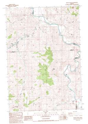
Muddy Ranch Topo Map Oregon
To zoom in, hover over the map of Muddy Ranch
USGS Topo Quad 44120g4 - 1:24,000 scale
| Topo Map Name: | Muddy Ranch |
| USGS Topo Quad ID: | 44120g4 |
| Print Size: | ca. 21 1/4" wide x 27" high |
| Southeast Coordinates: | 44.75° N latitude / 120.375° W longitude |
| Map Center Coordinates: | 44.8125° N latitude / 120.4375° W longitude |
| U.S. State: | OR |
| Filename: | o44120g4.jpg |
| Download Map JPG Image: | Muddy Ranch topo map 1:24,000 scale |
| Map Type: | Topographic |
| Topo Series: | 7.5´ |
| Map Scale: | 1:24,000 |
| Source of Map Images: | United States Geological Survey (USGS) |
| Alternate Map Versions: |
Muddy Ranch OR 1987, updated 1988 Download PDF Buy paper map Muddy Ranch OR 2011 Download PDF Buy paper map Muddy Ranch OR 2014 Download PDF Buy paper map |
1:24,000 Topo Quads surrounding Muddy Ranch
> Back to 44120e1 at 1:100,000 scale
> Back to 44120a1 at 1:250,000 scale
> Back to U.S. Topo Maps home
Muddy Ranch topo map: Gazetteer
Muddy Ranch: Dams
Currant Creek Dam elevation 451m 1479′Muddy Ranch: Pillars
Black Rock elevation 602m 1975′Mays Rock elevation 870m 2854′
Post Pile Rock elevation 522m 1712′
Muddy Ranch: Post Offices
Cherry Creek Post Office (historical) elevation 482m 1581′Muddy Ranch: Reservoirs
Currant Creek Reservoir elevation 451m 1479′Muddy Reservoir elevation 473m 1551′
Muddy Ranch: Ridges
Domogalla Ridge elevation 849m 2785′Melendy Ridge elevation 953m 3126′
Muddy Ranch: Streams
Cherry Creek elevation 434m 1423′Currant Creek elevation 475m 1558′
Dry Creek elevation 402m 1318′
Muddy Creek elevation 403m 1322′
Ross Creek elevation 642m 2106′
Muddy Ranch: Summits
Currant Peak elevation 576m 1889′Ross Butte elevation 918m 3011′
Wagner Mountain elevation 974m 3195′
Muddy Ranch: Valleys
Domogalla Canyon elevation 499m 1637′Eagle Canyon elevation 463m 1519′
Hay Bottom Canyon elevation 427m 1400′
MacDonald Canyon elevation 420m 1377′
Rock Canyon elevation 430m 1410′
Ross Canyon elevation 656m 2152′
Spring Basin Canyon elevation 470m 1541′
Muddy Ranch digital topo map on disk
Buy this Muddy Ranch topo map showing relief, roads, GPS coordinates and other geographical features, as a high-resolution digital map file on DVD:


