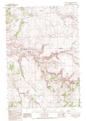
Degner Canyon Topo Map Oregon
To zoom in, hover over the map of Degner Canyon
USGS Topo Quad 44120g7 - 1:24,000 scale
| Topo Map Name: | Degner Canyon |
| USGS Topo Quad ID: | 44120g7 |
| Print Size: | ca. 21 1/4" wide x 27" high |
| Southeast Coordinates: | 44.75° N latitude / 120.75° W longitude |
| Map Center Coordinates: | 44.8125° N latitude / 120.8125° W longitude |
| U.S. State: | OR |
| Filename: | o44120g7.jpg |
| Download Map JPG Image: | Degner Canyon topo map 1:24,000 scale |
| Map Type: | Topographic |
| Topo Series: | 7.5´ |
| Map Scale: | 1:24,000 |
| Source of Map Images: | United States Geological Survey (USGS) |
| Alternate Map Versions: |
Degner Canyon OR 1987, updated 1988 Download PDF Buy paper map Degner Canyon OR 2011 Download PDF Buy paper map Degner Canyon OR 2014 Download PDF Buy paper map |
1:24,000 Topo Quads surrounding Degner Canyon
> Back to 44120e1 at 1:100,000 scale
> Back to 44120a1 at 1:250,000 scale
> Back to U.S. Topo Maps home
Degner Canyon topo map: Gazetteer
Degner Canyon: Basins
Paulina Basin elevation 791m 2595′Degner Canyon: Springs
Cottonwood Spring elevation 822m 2696′Degner Spring elevation 783m 2568′
Kimsey Springs elevation 720m 2362′
Lower Spring elevation 878m 2880′
Tub Springs elevation 902m 2959′
Degner Canyon: Streams
Cold Camp Creek elevation 697m 2286′Dry Creek elevation 746m 2447′
Indian Creek elevation 699m 2293′
Juniper Creek elevation 605m 1984′
King Creek elevation 734m 2408′
Little Trout Creek elevation 724m 2375′
Degner Canyon: Summits
Paulina Butte elevation 1047m 3435′Sheep Rock elevation 881m 2890′
Degner Canyon: Valleys
Blind Canyon elevation 706m 2316′Degner Canyon elevation 646m 2119′
Forman Canyon elevation 692m 2270′
King Canyon elevation 714m 2342′
Kirkbride Canyon elevation 828m 2716′
Long Hollow elevation 742m 2434′
Sand Hollow elevation 631m 2070′
Sheep Hollow elevation 737m 2417′
Timber Culture Gulch elevation 746m 2447′
Tub Springs Canyon elevation 669m 2194′
Degner Canyon digital topo map on disk
Buy this Degner Canyon topo map showing relief, roads, GPS coordinates and other geographical features, as a high-resolution digital map file on DVD:


