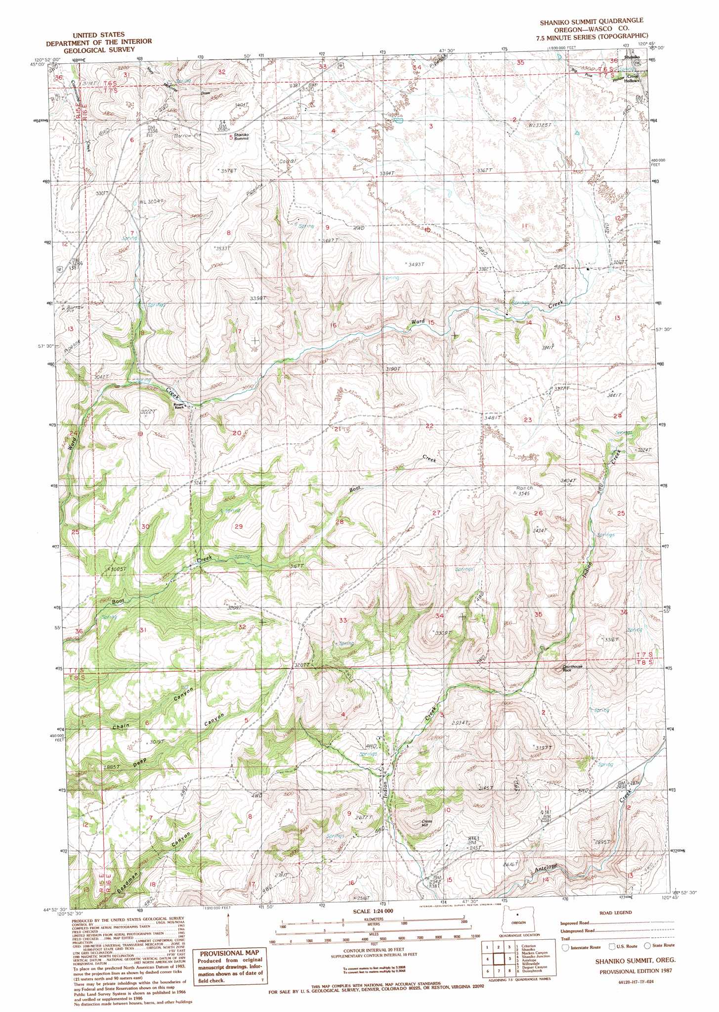
Shaniko Summit Topo Map Oregon
To zoom in, hover over the map of Shaniko Summit
USGS Topo Quad 44120h7 - 1:24,000 scale
| Topo Map Name: | Shaniko Summit |
| USGS Topo Quad ID: | 44120h7 |
| Print Size: | ca. 21 1/4" wide x 27" high |
| Southeast Coordinates: | 44.875° N latitude / 120.75° W longitude |
| Map Center Coordinates: | 44.9375° N latitude / 120.8125° W longitude |
| U.S. State: | OR |
| Filename: | o44120h7.jpg |
| Download Map JPG Image: | Shaniko Summit topo map 1:24,000 scale |
| Map Type: | Topographic |
| Topo Series: | 7.5´ |
| Map Scale: | 1:24,000 |
| Source of Map Images: | United States Geological Survey (USGS) |
| Alternate Map Versions: |
Shaniko Summit OR 1987, updated 1988 Download PDF Buy paper map Shaniko Summit OR 2011 Download PDF Buy paper map Shaniko Summit OR 2014 Download PDF Buy paper map |
1:24,000 Topo Quads surrounding Shaniko Summit
Maupin |
Dead Dog Canyon |
Bronx Canyon |
Kent |
Horseshoe Bend |
Dant |
Criterion |
Shaniko |
Macken Canyon |
Bath Canyon |
Kaskela |
Shaniko Junction |
Shaniko Summit |
Antelope |
Hastings Peak |
Gateway |
Willowdale |
Degner Canyon |
Donnybrook |
Arrastra Butte |
Madras East |
Teller Butte |
Ashwood |
Axehandle Butte |
Horse Heaven Creek |
> Back to 44120e1 at 1:100,000 scale
> Back to 44120a1 at 1:250,000 scale
> Back to U.S. Topo Maps home
Shaniko Summit topo map: Gazetteer
Shaniko Summit: Gaps
Shaniko Summit elevation 1097m 3599′Shaniko Summit: Pillars
Courthouse Rock elevation 962m 3156′Shaniko Summit: Post Offices
Cross Hollows Post Office (historical) elevation 983m 3225′Shaniko Summit: Summits
Cross Hill elevation 839m 2752′Shaniko Summit digital topo map on disk
Buy this Shaniko Summit topo map showing relief, roads, GPS coordinates and other geographical features, as a high-resolution digital map file on DVD: