Black Crater Topo Map Oregon
To zoom in, hover over the map of Black Crater
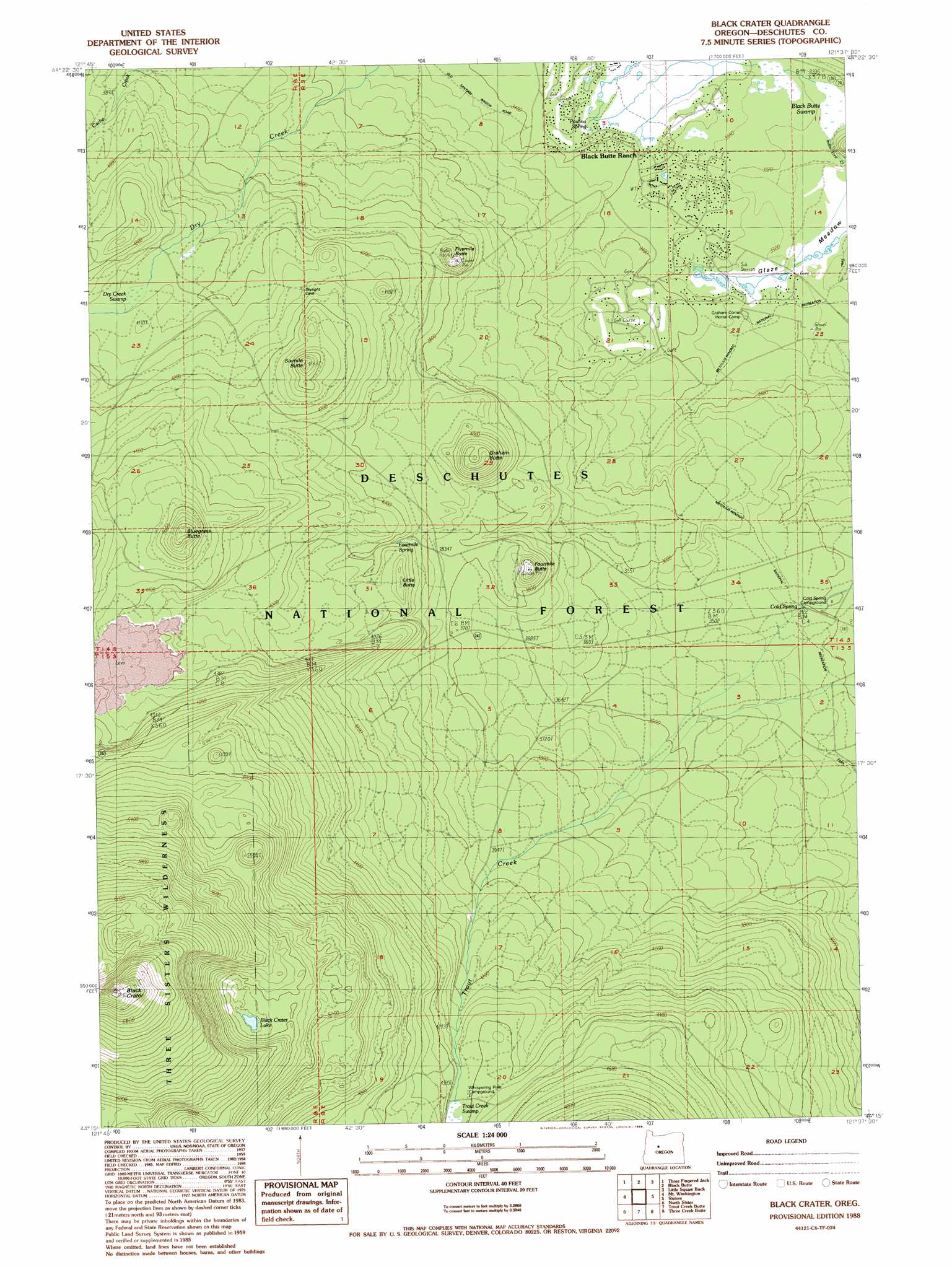
USGS Topo Quad 44121c6 - 1:24,000 scale
| Topo Map Name: | Black Crater |
| USGS Topo Quad ID: | 44121c6 |
| Print Size: | ca. 21 1/4" wide x 27" high |
| Southeast Coordinates: | 44.25° N latitude / 121.625° W longitude |
| Map Center Coordinates: | 44.3125° N latitude / 121.6875° W longitude |
| U.S. State: | OR |
| Filename: | o44121c6.jpg |
| Download Map JPG Image: | Black Crater topo map 1:24,000 scale |
| Map Type: | Topographic |
| Topo Series: | 7.5´ |
| Map Scale: | 1:24,000 |
| Source of Map Images: | United States Geological Survey (USGS) |
| Alternate Map Versions: |
Black Crater OR 1988, updated 1988 Download PDF Buy paper map Black Crater OR 2011 Download PDF Buy paper map Black Crater OR 2014 Download PDF Buy paper map |
| FStopo: | US Forest Service topo Black Crater is available: Download FStopo PDF Download FStopo TIF |
1:24,000 Topo Quads surrounding Black Crater
Marion Forks |
Marion Lake |
Candle Creek |
Prairie Farm Spring |
Fly Creek |
Santiam Junction |
Three Fingered Jack |
Black Butte |
Little Squaw Back |
Squaw Back Ridge |
Clear Lake |
Mount Washington |
Black Crater |
Sisters |
Henkle Butte |
Linton Lake |
North Sister |
Trout Creek Butte |
Three Creek Butte |
Tumalo Dam |
Substitute Point |
South Sister |
Lake Geneva |
Tumalo Falls |
Shevlin Park |
> Back to 44121a1 at 1:100,000 scale
> Back to 44120a1 at 1:250,000 scale
> Back to U.S. Topo Maps home
Black Crater topo map: Gazetteer
Black Crater: Craters
Black Crater elevation 2204m 7230′Latta Crater elevation 1901m 6236′
Black Crater: Dams
Nootnagle Dam elevation 1335m 4379′Black Crater: Flats
Glaze Meadow elevation 1007m 3303′Black Crater: Lakes
Black Crater Lake elevation 1620m 5314′Black Crater: Reservoirs
Nootnagle Reservoir elevation 1335m 4379′Black Crater: Springs
Cold Spring elevation 1038m 3405′Fourmile Spring elevation 1206m 3956′
Paulina Spring elevation 1025m 3362′
Black Crater: Streams
Trout Creek elevation 1039m 3408′Black Crater: Summits
Bluegrass Butte elevation 1486m 4875′Fivemile Butte elevation 1237m 4058′
Fourmile Butte elevation 1235m 4051′
Graham Butte elevation 1275m 4183′
Little Butte elevation 1260m 4133′
Sixmile Butte elevation 1383m 4537′
Black Crater: Swamps
Black Butte Swamp elevation 1009m 3310′Dry Creek elevation 1230m 4035′
Black Crater digital topo map on disk
Buy this Black Crater topo map showing relief, roads, GPS coordinates and other geographical features, as a high-resolution digital map file on DVD: