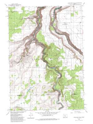
Steelhead Falls Topo Map Oregon
To zoom in, hover over the map of Steelhead Falls
USGS Topo Quad 44121d3 - 1:24,000 scale
| Topo Map Name: | Steelhead Falls |
| USGS Topo Quad ID: | 44121d3 |
| Print Size: | ca. 21 1/4" wide x 27" high |
| Southeast Coordinates: | 44.375° N latitude / 121.25° W longitude |
| Map Center Coordinates: | 44.4375° N latitude / 121.3125° W longitude |
| U.S. State: | OR |
| Filename: | o44121d3.jpg |
| Download Map JPG Image: | Steelhead Falls topo map 1:24,000 scale |
| Map Type: | Topographic |
| Topo Series: | 7.5´ |
| Map Scale: | 1:24,000 |
| Source of Map Images: | United States Geological Survey (USGS) |
| Alternate Map Versions: |
Steelhead Falls OR 1962, updated 1964 Download PDF Buy paper map Steelhead Falls OR 1962, updated 1976 Download PDF Buy paper map Steelhead Falls OR 1985, updated 1986 Download PDF Buy paper map Steelhead Falls OR 1992, updated 1997 Download PDF Buy paper map Steelhead Falls OR 1992, updated 1997 Download PDF Buy paper map Steelhead Falls OR 2011 Download PDF Buy paper map Steelhead Falls OR 2014 Download PDF Buy paper map |
| FStopo: | US Forest Service topo Steelhead Falls is available: Download FStopo PDF Download FStopo TIF |
1:24,000 Topo Quads surrounding Steelhead Falls
> Back to 44121a1 at 1:100,000 scale
> Back to 44120a1 at 1:250,000 scale
> Back to U.S. Topo Maps home
Steelhead Falls topo map: Gazetteer
Steelhead Falls: Falls
Steelhead Falls elevation 705m 2312′Steelhead Falls: Springs
Opal Springs elevation 661m 2168′Steelhead Falls: Streams
Whychus Creek elevation 642m 2106′Steelhead Falls: Summits
Green Mountain elevation 846m 2775′Steelhead Falls: Valleys
Carcass Canyon elevation 644m 2112′Potter Canyon elevation 617m 2024′
Whychus Creek Canyon elevation 667m 2188′
Steelhead Falls digital topo map on disk
Buy this Steelhead Falls topo map showing relief, roads, GPS coordinates and other geographical features, as a high-resolution digital map file on DVD:


