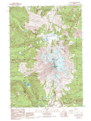
Mount Jefferson Topo Map Oregon
To zoom in, hover over the map of Mount Jefferson
USGS Topo Quad 44121f7 - 1:24,000 scale
| Topo Map Name: | Mount Jefferson |
| USGS Topo Quad ID: | 44121f7 |
| Print Size: | ca. 21 1/4" wide x 27" high |
| Southeast Coordinates: | 44.625° N latitude / 121.75° W longitude |
| Map Center Coordinates: | 44.6875° N latitude / 121.8125° W longitude |
| U.S. State: | OR |
| Filename: | o44121f7.jpg |
| Download Map JPG Image: | Mount Jefferson topo map 1:24,000 scale |
| Map Type: | Topographic |
| Topo Series: | 7.5´ |
| Map Scale: | 1:24,000 |
| Source of Map Images: | United States Geological Survey (USGS) |
| Alternate Map Versions: |
Mt. Jefferson OR 1988, updated 1994 Download PDF Buy paper map Mt. Jefferson OR 1988, updated 1998 Download PDF Buy paper map Mount Jefferson OR 1997, updated 2001 Download PDF Buy paper map Mount Jefferson OR 2011 Download PDF Buy paper map Mount Jefferson OR 2014 Download PDF Buy paper map |
| FStopo: | US Forest Service topo Mount Jefferson is available: Download FStopo PDF Download FStopo TIF |
1:24,000 Topo Quads surrounding Mount Jefferson
> Back to 44121e1 at 1:100,000 scale
> Back to 44120a1 at 1:250,000 scale
> Back to U.S. Topo Maps home
Mount Jefferson topo map: Gazetteer
Mount Jefferson: Basins
Hunts Cove elevation 1608m 5275′Mount Jefferson: Flats
Grizzly Flat elevation 1454m 4770′Hole-in-the-Wall Park elevation 1597m 5239′
Kuckup Park elevation 1724m 5656′
Mount Jefferson: Glaciers
Jefferson Park Glacier elevation 2578m 8458′Milk Creek Glacier elevation 2854m 9363′
Russell Glacier elevation 2242m 7355′
Waldo Glacier elevation 2532m 8307′
Whitewater Glacier elevation 2477m 8126′
Mount Jefferson: Lakes
Bays Lake elevation 1778m 5833′Bear Lake elevation 1612m 5288′
Coyote Lake elevation 1794m 5885′
Hanks Lake elevation 1570m 5150′
Hunts Lake elevation 1594m 5229′
Lizard Lake elevation 1538m 5045′
Pamelia Lake elevation 1190m 3904′
Park Lake elevation 1765m 5790′
Rock Lake elevation 1769m 5803′
Russell Lake elevation 1792m 5879′
Scout Lake elevation 1779m 5836′
Shale Lake elevation 1793m 5882′
Sprague Lake elevation 1999m 6558′
Whitewater Lake elevation 1155m 3789′
Mount Jefferson: Springs
Flapper Springs elevation 1268m 4160′Mount Jefferson: Streams
Hunts Creek elevation 1191m 3907′Jeff Creek elevation 1142m 3746′
Mount Jefferson: Summits
Bear Butte elevation 1815m 5954′Dinah-mo Peak elevation 1961m 6433′
Goat Peak elevation 2144m 7034′
Grizzly Peak elevation 1756m 5761′
Mount Jefferson elevation 3123m 10246′
Park Butte elevation 2058m 6751′
Quitters Point elevation 1589m 5213′
Sentinel Hills elevation 1663m 5456′
Mount Jefferson: Trails
Jefferson Creek Trail elevation 1831m 6007′Jefferson Park Trail elevation 1602m 5255′
Pamelia Lake Trail elevation 1095m 3592′
Mount Jefferson: Valleys
Jefferson Park elevation 1799m 5902′Mount Jefferson digital topo map on disk
Buy this Mount Jefferson topo map showing relief, roads, GPS coordinates and other geographical features, as a high-resolution digital map file on DVD:


