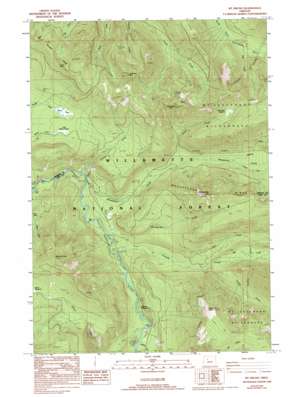
Mount Bruno Topo Map Oregon
To zoom in, hover over the map of Mount Bruno
USGS Topo Quad 44121f8 - 1:24,000 scale
| Topo Map Name: | Mount Bruno |
| USGS Topo Quad ID: | 44121f8 |
| Print Size: | ca. 21 1/4" wide x 27" high |
| Southeast Coordinates: | 44.625° N latitude / 121.875° W longitude |
| Map Center Coordinates: | 44.6875° N latitude / 121.9375° W longitude |
| U.S. State: | OR |
| Filename: | o44121f8.jpg |
| Download Map JPG Image: | Mount Bruno topo map 1:24,000 scale |
| Map Type: | Topographic |
| Topo Series: | 7.5´ |
| Map Scale: | 1:24,000 |
| Source of Map Images: | United States Geological Survey (USGS) |
| Alternate Map Versions: |
Mt. Bruno OR 1988, updated 1988 Download PDF Buy paper map Mt. Bruno OR 1988, updated 1994 Download PDF Buy paper map Mount Bruno OR 1994, updated 1998 Download PDF Buy paper map Mount Bruno OR 2011 Download PDF Buy paper map Mount Bruno OR 2014 Download PDF Buy paper map |
| FStopo: | US Forest Service topo Mount Bruno is available: Download FStopo PDF Download FStopo TIF |
1:24,000 Topo Quads surrounding Mount Bruno
> Back to 44121e1 at 1:100,000 scale
> Back to 44120a1 at 1:250,000 scale
> Back to U.S. Topo Maps home
Mount Bruno topo map: Gazetteer
Mount Bruno: Flats
Wild Cheat Meadow elevation 1269m 4163′Mount Bruno: Lakes
Peasley Lake elevation 718m 2355′Mount Bruno: Parks
Big Springs Campground (historical) elevation 626m 2053′Whitewater Campground (historical) elevation 675m 2214′
Mount Bruno: Pillars
Spire Rock elevation 1515m 4970′Mount Bruno: Ridges
Boulder Ridge elevation 1522m 4993′Woodpecker Ridge elevation 1418m 4652′
Mount Bruno: Streams
Cheat Creek elevation 814m 2670′Crag Creek elevation 920m 3018′
Grizzly Creek elevation 851m 2791′
Milk Creek elevation 1383m 4537′
Minto Creek elevation 731m 2398′
Pamelia Creek elevation 696m 2283′
Red Creek elevation 766m 2513′
Russell Creek elevation 940m 3083′
Sentinel Creek elevation 919m 3015′
Spring Creek elevation 644m 2112′
Tunnel Creek elevation 655m 2148′
Whitewater Creek elevation 643m 2109′
Woodpecker Creek elevation 720m 2362′
Mount Bruno: Summits
Gale Hill elevation 1506m 4940′Minto Mountain elevation 1563m 5127′
Mount Bruno elevation 1614m 5295′
Outerson Mountain elevation 1577m 5173′
Timber Butte elevation 1569m 5147′
Triangulation Peak elevation 1576m 5170′
Woodpecker Hill elevation 1527m 5009′
Mount Bruno: Swamps
Little Pigeon Prairie elevation 1108m 3635′Pigeon Prairie elevation 1096m 3595′
Mount Bruno: Trails
Bachelor Mountain Trail elevation 1454m 4770′South Breitenbush Trail elevation 1032m 3385′
Woodpecker Trail elevation 1503m 4931′
Mount Bruno digital topo map on disk
Buy this Mount Bruno topo map showing relief, roads, GPS coordinates and other geographical features, as a high-resolution digital map file on DVD:


