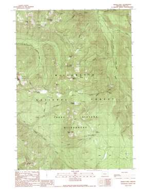
French Mountain Topo Map Oregon
To zoom in, hover over the map of French Mountain
USGS Topo Quad 44122a1 - 1:24,000 scale
| Topo Map Name: | French Mountain |
| USGS Topo Quad ID: | 44122a1 |
| Print Size: | ca. 21 1/4" wide x 27" high |
| Southeast Coordinates: | 44° N latitude / 122° W longitude |
| Map Center Coordinates: | 44.0625° N latitude / 122.0625° W longitude |
| U.S. State: | OR |
| Filename: | o44122a1.jpg |
| Download Map JPG Image: | French Mountain topo map 1:24,000 scale |
| Map Type: | Topographic |
| Topo Series: | 7.5´ |
| Map Scale: | 1:24,000 |
| Source of Map Images: | United States Geological Survey (USGS) |
| Alternate Map Versions: |
French Mountain OR 1989, updated 1989 Download PDF Buy paper map French Mountain OR 1997, updated 2001 Download PDF Buy paper map French Mountain OR 2011 Download PDF Buy paper map French Mountain OR 2014 Download PDF Buy paper map |
| FStopo: | US Forest Service topo French Mountain is available: Download FStopo PDF Download FStopo TIF |
1:24,000 Topo Quads surrounding French Mountain
> Back to 44122a1 at 1:100,000 scale
> Back to 44122a1 at 1:250,000 scale
> Back to U.S. Topo Maps home
French Mountain topo map: Gazetteer
French Mountain: Basins
The Potholes elevation 1535m 5036′French Mountain: Flats
Bear Flat elevation 1475m 4839′Olallie Meadows elevation 1418m 4652′
Pothole Meadow elevation 1334m 4376′
Wolverine Meadow elevation 1437m 4714′
French Mountain: Lakes
Karl Lake elevation 1400m 4593′Ruth Lake elevation 1419m 4655′
French Mountain: Streams
Aspen Creek elevation 1095m 3592′Castle Creek elevation 623m 2043′
Eugene Creek elevation 826m 2709′
Louise Creek elevation 708m 2322′
Mosquito Creek elevation 779m 2555′
Olallie Creek elevation 1036m 3398′
Pasture Creek elevation 604m 1981′
Pat Creek elevation 917m 3008′
Pothole Creek elevation 708m 2322′
Roney Creek elevation 668m 2191′
Separation Creek elevation 628m 2060′
French Mountain: Summits
English Mountain elevation 1707m 5600′French Mountain elevation 1732m 5682′
Horsepasture Mountain elevation 1717m 5633′
Lamb Butte elevation 1654m 5426′
Olallie Mountain elevation 1736m 5695′
O'Leary Mountain elevation 1688m 5538′
Pyramid Mountain elevation 1701m 5580′
Taylor Castle elevation 1646m 5400′
French Mountain: Swamps
Quaking Aspen Swamp elevation 1362m 4468′French Mountain: Trails
Olallie Trail elevation 1464m 4803′Pyramid Trail elevation 1507m 4944′
Saddle Trail elevation 1155m 3789′
French Mountain digital topo map on disk
Buy this French Mountain topo map showing relief, roads, GPS coordinates and other geographical features, as a high-resolution digital map file on DVD:


