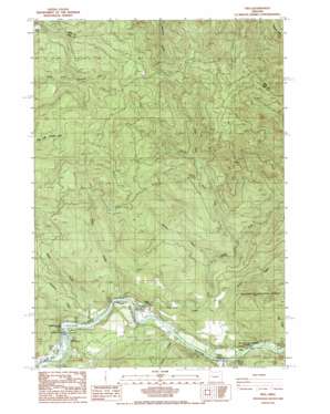
Vida Topo Map Oregon
To zoom in, hover over the map of Vida
USGS Topo Quad 44122b5 - 1:24,000 scale
| Topo Map Name: | Vida |
| USGS Topo Quad ID: | 44122b5 |
| Print Size: | ca. 21 1/4" wide x 27" high |
| Southeast Coordinates: | 44.125° N latitude / 122.5° W longitude |
| Map Center Coordinates: | 44.1875° N latitude / 122.5625° W longitude |
| U.S. State: | OR |
| Filename: | o44122b5.jpg |
| Download Map JPG Image: | Vida topo map 1:24,000 scale |
| Map Type: | Topographic |
| Topo Series: | 7.5´ |
| Map Scale: | 1:24,000 |
| Source of Map Images: | United States Geological Survey (USGS) |
| Alternate Map Versions: |
Vida OR 1988, updated 1988 Download PDF Buy paper map Vida OR 1997, updated 2001 Download PDF Buy paper map Vida OR 2011 Download PDF Buy paper map Vida OR 2014 Download PDF Buy paper map |
| FStopo: | US Forest Service topo Vida is available: Download FStopo PDF Download FStopo TIF |
1:24,000 Topo Quads surrounding Vida
> Back to 44122a1 at 1:100,000 scale
> Back to 44122a1 at 1:250,000 scale
> Back to U.S. Topo Maps home
Vida topo map: Gazetteer
Vida: Dams
Leaburg Dam elevation 224m 734′Vida: Parks
Ben and Kay Dorris County Park elevation 344m 1128′Gate Creek Park elevation 281m 921′
Helfrich Landing County Park elevation 268m 879′
Marten Rapids Park elevation 248m 813′
Old McKenzie Fish Hatchery County Park elevation 235m 770′
Waterboard Park elevation 226m 741′
Vida: Pillars
Finn Rock elevation 238m 780′Vida: Populated Places
Vida elevation 251m 823′Vida: Post Offices
Elliston Post Office (historical) elevation 234m 767′Gate Creek Post Office (historical) elevation 239m 784′
Gate Creek Post Office (historical) elevation 442m 1450′
Vida Post Office elevation 251m 823′
Vida: Rapids
Marten Rapids elevation 252m 826′Vida: Reservoirs
Leaburg Reservoir elevation 224m 734′Vida: Streams
Finn Creek elevation 230m 754′Gate Creek elevation 234m 767′
Granite Creek elevation 230m 754′
Hatchery Creek elevation 231m 757′
Honey Creek elevation 248m 813′
Indian Creek elevation 234m 767′
Marten Creek elevation 244m 800′
Minney Creek elevation 297m 974′
North Fork Gate Creek elevation 278m 912′
North Fork North Fork Gate Creek elevation 315m 1033′
Potts Creek elevation 422m 1384′
Roberts Creek elevation 240m 787′
South Fork Gate Creek elevation 277m 908′
Toms Creek elevation 244m 800′
Trout Creek elevation 225m 738′
Vida: Trails
Michigan Heights Trail elevation 964m 3162′Vida digital topo map on disk
Buy this Vida topo map showing relief, roads, GPS coordinates and other geographical features, as a high-resolution digital map file on DVD:


