Mount Nebo Topo Map Oregon
To zoom in, hover over the map of Mount Nebo
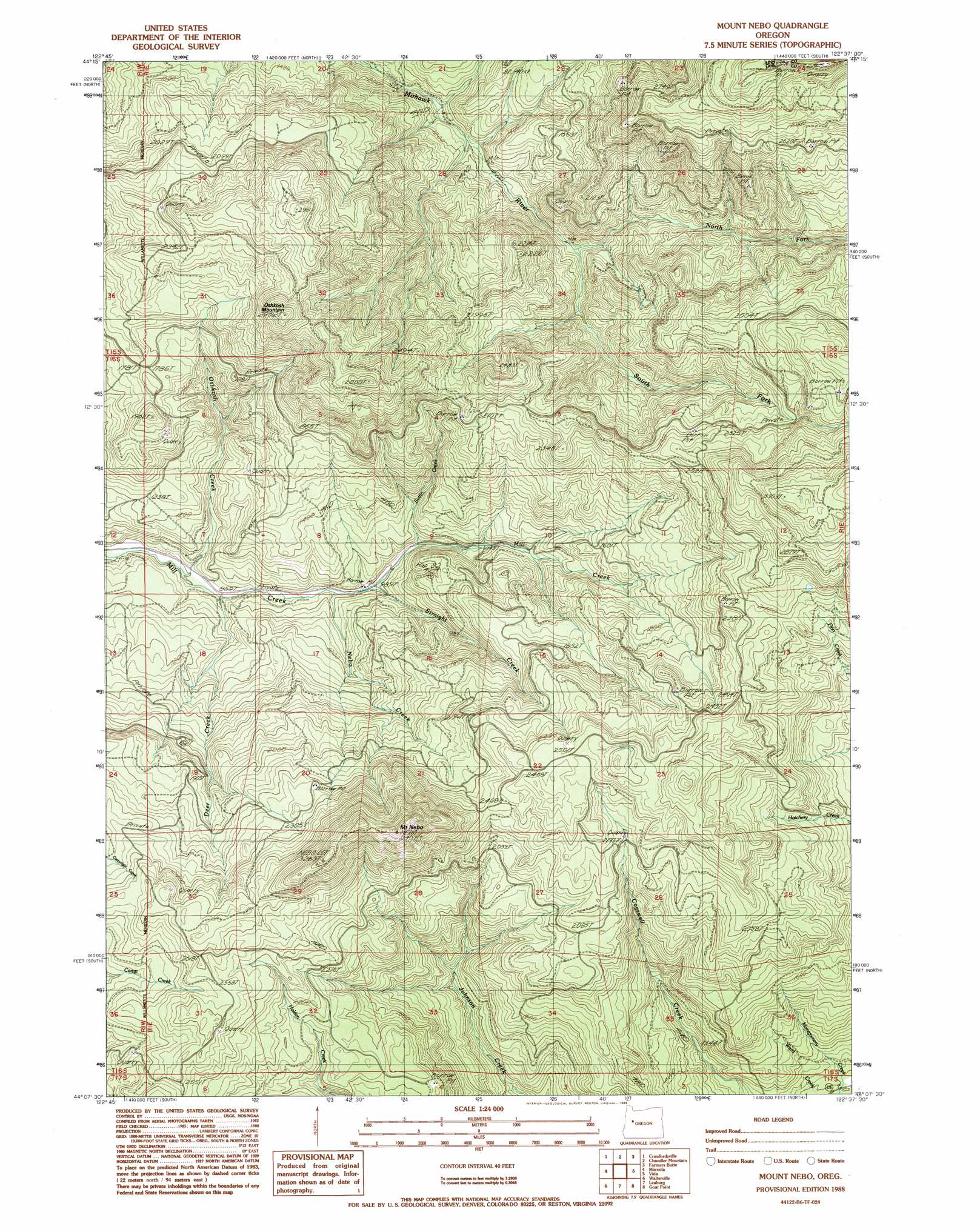
USGS Topo Quad 44122b6 - 1:24,000 scale
| Topo Map Name: | Mount Nebo |
| USGS Topo Quad ID: | 44122b6 |
| Print Size: | ca. 21 1/4" wide x 27" high |
| Southeast Coordinates: | 44.125° N latitude / 122.625° W longitude |
| Map Center Coordinates: | 44.1875° N latitude / 122.6875° W longitude |
| U.S. State: | OR |
| Filename: | o44122b6.jpg |
| Download Map JPG Image: | Mount Nebo topo map 1:24,000 scale |
| Map Type: | Topographic |
| Topo Series: | 7.5´ |
| Map Scale: | 1:24,000 |
| Source of Map Images: | United States Geological Survey (USGS) |
| Alternate Map Versions: |
Mount Nebo OR 1988, updated 1988 Download PDF Buy paper map Mount Nebo OR 2011 Download PDF Buy paper map Mount Nebo OR 2014 Download PDF Buy paper map |
1:24,000 Topo Quads surrounding Mount Nebo
Brownsville |
Waterloo |
Sweet Home |
Green Peter |
Cascadia |
Union Point |
Crawfordsville |
Chandler Mountain |
Farmers Butte |
Swamp Mountain |
Mohawk |
Marcola |
Mount Nebo |
Vida |
Mount Hagan |
Springfield |
Walterville |
Leaburg |
Goat Mountain |
Nimrod |
Jasper |
Lowell |
Fall Creek Lake |
Saddleblanket Mountain |
Sinker Mountain |
> Back to 44122a1 at 1:100,000 scale
> Back to 44122a1 at 1:250,000 scale
> Back to U.S. Topo Maps home
Mount Nebo topo map: Gazetteer
Mount Nebo: Streams
Buttin Creek elevation 327m 1072′Deer Creek elevation 257m 843′
Drake Creek elevation 325m 1066′
Nebo Creek elevation 290m 951′
North Fork Mohawk River elevation 391m 1282′
Oshkosh Creek elevation 247m 810′
South Fork Mohawk River elevation 390m 1279′
Straight Creek elevation 307m 1007′
Mount Nebo: Summits
Mount Nebo elevation 988m 3241′Oshkosh Mountain elevation 894m 2933′
Mount Nebo digital topo map on disk
Buy this Mount Nebo topo map showing relief, roads, GPS coordinates and other geographical features, as a high-resolution digital map file on DVD: