Crawfordsville Topo Map Oregon
To zoom in, hover over the map of Crawfordsville
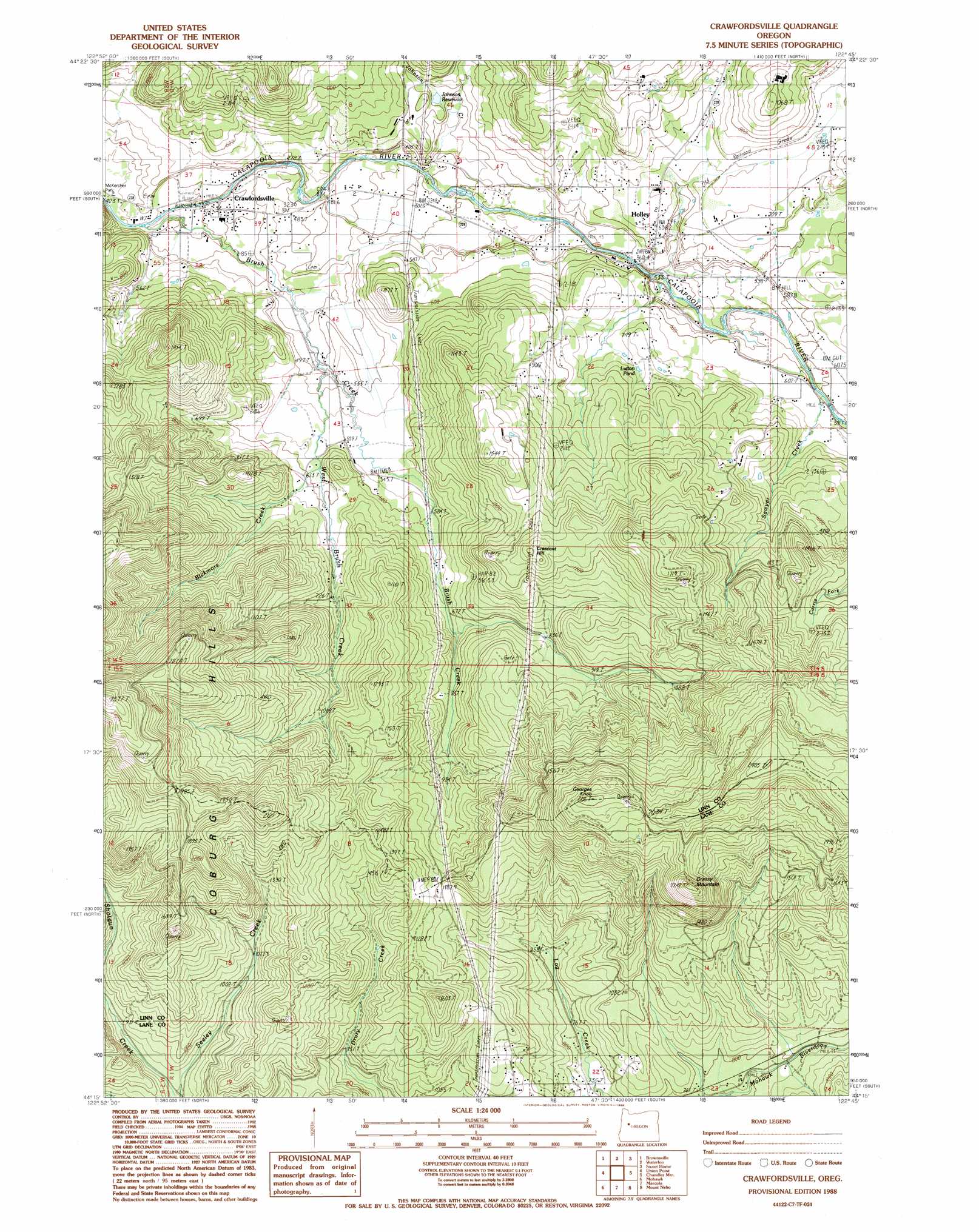
USGS Topo Quad 44122c7 - 1:24,000 scale
| Topo Map Name: | Crawfordsville |
| USGS Topo Quad ID: | 44122c7 |
| Print Size: | ca. 21 1/4" wide x 27" high |
| Southeast Coordinates: | 44.25° N latitude / 122.75° W longitude |
| Map Center Coordinates: | 44.3125° N latitude / 122.8125° W longitude |
| U.S. State: | OR |
| Filename: | o44122c7.jpg |
| Download Map JPG Image: | Crawfordsville topo map 1:24,000 scale |
| Map Type: | Topographic |
| Topo Series: | 7.5´ |
| Map Scale: | 1:24,000 |
| Source of Map Images: | United States Geological Survey (USGS) |
| Alternate Map Versions: |
Crawfordsville OR 1988, updated 1988 Download PDF Buy paper map Crawfordsville OR 2011 Download PDF Buy paper map Crawfordsville OR 2014 Download PDF Buy paper map |
1:24,000 Topo Quads surrounding Crawfordsville
Tangent |
Lebanon |
Onehorse Slough |
Lacomb |
Keel Mountain |
Halsey |
Brownsville |
Waterloo |
Sweet Home |
Green Peter |
Indian Head |
Union Point |
Crawfordsville |
Chandler Mountain |
Farmers Butte |
Coburg |
Mohawk |
Marcola |
Mount Nebo |
Vida |
Eugene East |
Springfield |
Walterville |
Leaburg |
Goat Mountain |
> Back to 44122a1 at 1:100,000 scale
> Back to 44122a1 at 1:250,000 scale
> Back to U.S. Topo Maps home
Crawfordsville topo map: Gazetteer
Crawfordsville: Bridges
Crawfordsville Bridge elevation 136m 446′Matlock Bridge elevation 173m 567′
Crawfordsville: Lakes
Ernests Pond elevation 608m 1994′Lutton Pond elevation 223m 731′
Crawfordsville: Parks
McClun Wayside County Park elevation 185m 606′Crawfordsville: Populated Places
Crawfordsville elevation 140m 459′Holley elevation 192m 629′
Crawfordsville: Post Offices
Crawfordsville Post Office elevation 140m 459′Holley Post Office (historical) elevation 192m 629′
Crawfordsville: Reservoirs
Johnson Creek Reservoir elevation 169m 554′Johnson Reservoir elevation 166m 544′
Crawfordsville: Springs
Noble Spring elevation 221m 725′Crawfordsville: Streams
Bickmore Creek elevation 177m 580′Brush Creek elevation 135m 442′
Johnson Creek elevation 150m 492′
Sawyer Creek elevation 182m 597′
West Brush Creek elevation 150m 492′
Crawfordsville: Summits
Crescent Hill elevation 426m 1397′Georges Knob elevation 676m 2217′
Grassy Mountain elevation 671m 2201′
Crawfordsville digital topo map on disk
Buy this Crawfordsville topo map showing relief, roads, GPS coordinates and other geographical features, as a high-resolution digital map file on DVD: