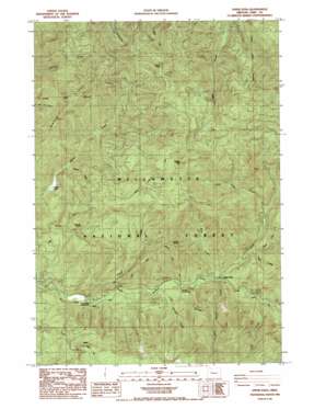
Upper Soda Topo Map Oregon
To zoom in, hover over the map of Upper Soda
USGS Topo Quad 44122d3 - 1:24,000 scale
| Topo Map Name: | Upper Soda |
| USGS Topo Quad ID: | 44122d3 |
| Print Size: | ca. 21 1/4" wide x 27" high |
| Southeast Coordinates: | 44.375° N latitude / 122.25° W longitude |
| Map Center Coordinates: | 44.4375° N latitude / 122.3125° W longitude |
| U.S. State: | OR |
| Filename: | o44122d3.jpg |
| Download Map JPG Image: | Upper Soda topo map 1:24,000 scale |
| Map Type: | Topographic |
| Topo Series: | 7.5´ |
| Map Scale: | 1:24,000 |
| Source of Map Images: | United States Geological Survey (USGS) |
| Alternate Map Versions: |
Upper Soda OR 1985, updated 1985 Download PDF Buy paper map Upper Soda OR 1994, updated 1998 Download PDF Buy paper map Upper Soda OR 2011 Download PDF Buy paper map Upper Soda OR 2014 Download PDF Buy paper map |
| FStopo: | US Forest Service topo Upper Soda is available: Download FStopo PDF Download FStopo TIF |
1:24,000 Topo Quads surrounding Upper Soda
> Back to 44122a1 at 1:100,000 scale
> Back to 44122a1 at 1:250,000 scale
> Back to U.S. Topo Maps home
Upper Soda topo map: Gazetteer
Upper Soda: Capes
Bloody Point elevation 959m 3146′Upper Soda: Lakes
Moose Lake elevation 475m 1558′Upper Soda: Pillars
Cougar Rock elevation 1393m 4570′Rooster Rock elevation 1041m 3415′
Upper Soda: Populated Places
Upper Soda elevation 431m 1414′Upper Soda: Post Offices
Garrison Post Office (historical) elevation 430m 1410′Upper Soda: Streams
Boulder Creek elevation 408m 1338′Channel Creek elevation 383m 1256′
Elk Creek elevation 479m 1571′
Harter Creek elevation 463m 1519′
Husky Creek elevation 486m 1594′
Keith Creek elevation 414m 1358′
Little Boulder Creek elevation 399m 1309′
Rooster Creek elevation 399m 1309′
Soda Fork elevation 439m 1440′
Stewart Creek elevation 414m 1358′
Taylor Creek elevation 456m 1496′
Trout Creek elevation 374m 1227′
Upper Soda: Summits
Moose Mountain elevation 1405m 4609′Upper Soda digital topo map on disk
Buy this Upper Soda topo map showing relief, roads, GPS coordinates and other geographical features, as a high-resolution digital map file on DVD:


