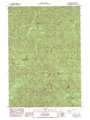
Quartzville Topo Map Oregon
To zoom in, hover over the map of Quartzville
USGS Topo Quad 44122e3 - 1:24,000 scale
| Topo Map Name: | Quartzville |
| USGS Topo Quad ID: | 44122e3 |
| Print Size: | ca. 21 1/4" wide x 27" high |
| Southeast Coordinates: | 44.5° N latitude / 122.25° W longitude |
| Map Center Coordinates: | 44.5625° N latitude / 122.3125° W longitude |
| U.S. State: | OR |
| Filename: | o44122e3.jpg |
| Download Map JPG Image: | Quartzville topo map 1:24,000 scale |
| Map Type: | Topographic |
| Topo Series: | 7.5´ |
| Map Scale: | 1:24,000 |
| Source of Map Images: | United States Geological Survey (USGS) |
| Alternate Map Versions: |
Quartzville OR 1985, updated 1985 Download PDF Buy paper map Quartzville OR 1994, updated 1998 Download PDF Buy paper map Quartzville OR 2011 Download PDF Buy paper map Quartzville OR 2014 Download PDF Buy paper map |
| FStopo: | US Forest Service topo Quartzville is available: Download FStopo PDF Download FStopo TIF |
1:24,000 Topo Quads surrounding Quartzville
> Back to 44122e1 at 1:100,000 scale
> Back to 44122a1 at 1:250,000 scale
> Back to U.S. Topo Maps home
Quartzville topo map: Gazetteer
Quartzville: Gaps
Red Heifer Pass elevation 1027m 3369′Quartzville: Mines
Albany Mine elevation 799m 2621′Quartzville: Parks
Yellowbottom Recreation Site elevation 443m 1453′Quartzville: Populated Places
Bryant City (historical) elevation 512m 1679′Quartzville: Ridges
Galena Ridge elevation 1265m 4150′Quartzville: Streams
Bear Creek elevation 452m 1482′Beverly Creek elevation 502m 1646′
Canal Creek elevation 466m 1528′
Cedar Creek elevation 500m 1640′
Crash Creek elevation 390m 1279′
Edison Creek elevation 710m 2329′
Elk Creek elevation 339m 1112′
Elk Creek elevation 543m 1781′
Galena Creek elevation 509m 1669′
Gold Creek elevation 574m 1883′
Green Creek elevation 550m 1804′
Gregg Creek elevation 597m 1958′
Maple Creek elevation 365m 1197′
McQuade Creek elevation 584m 1916′
Savage Creek elevation 509m 1669′
Silver Creek elevation 997m 3270′
Sixes Creek elevation 465m 1525′
Twin Falls Creek elevation 441m 1446′
West Fork McQuade Creek elevation 721m 2365′
Yellowbottom Creek elevation 444m 1456′
Quartzville: Summits
Galena Mountain elevation 1511m 4957′Gold Peak elevation 1209m 3966′
Green Mountain elevation 1272m 4173′
Red Heifer Mountain elevation 1078m 3536′
White Bull Mountain elevation 1115m 3658′
Quartzville: Trails
Minniece Point Trail elevation 1063m 3487′Quartzville: Valleys
Dry Gulch elevation 551m 1807′Edison Gulch elevation 698m 2290′
Quartzville digital topo map on disk
Buy this Quartzville topo map showing relief, roads, GPS coordinates and other geographical features, as a high-resolution digital map file on DVD:


