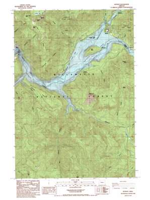
Detroit Topo Map Oregon
To zoom in, hover over the map of Detroit
USGS Topo Quad 44122f2 - 1:24,000 scale
| Topo Map Name: | Detroit |
| USGS Topo Quad ID: | 44122f2 |
| Print Size: | ca. 21 1/4" wide x 27" high |
| Southeast Coordinates: | 44.625° N latitude / 122.125° W longitude |
| Map Center Coordinates: | 44.6875° N latitude / 122.1875° W longitude |
| U.S. State: | OR |
| Filename: | o44122f2.jpg |
| Download Map JPG Image: | Detroit topo map 1:24,000 scale |
| Map Type: | Topographic |
| Topo Series: | 7.5´ |
| Map Scale: | 1:24,000 |
| Source of Map Images: | United States Geological Survey (USGS) |
| Alternate Map Versions: |
Detroit OR 1985, updated 1985 Download PDF Buy paper map Detroit OR 1994, updated 1998 Download PDF Buy paper map Detroit OR 2011 Download PDF Buy paper map Detroit OR 2014 Download PDF Buy paper map |
| FStopo: | US Forest Service topo Detroit is available: Download FStopo PDF Download FStopo TIF |
1:24,000 Topo Quads surrounding Detroit
> Back to 44122e1 at 1:100,000 scale
> Back to 44122a1 at 1:250,000 scale
> Back to U.S. Topo Maps home
Detroit topo map: Gazetteer
Detroit: Cliffs
Blowout Cliff elevation 1134m 3720′Detroit: Dams
Detroit Dam elevation 477m 1564′Detroit: Gaps
Beard Saddle elevation 964m 3162′Detroit: Islands
Piety Knob elevation 605m 1984′Detroit: Lakes
Tumble Lake elevation 1105m 3625′Detroit: Parks
Detroit Lake State Park elevation 488m 1601′Detroit: Pillars
Elephant Rock elevation 1358m 4455′Tumble Rock elevation 1360m 4461′
Whitman Rock elevation 1314m 4311′
Detroit: Populated Places
Detroit elevation 491m 1610′Detroit: Post Offices
Berry Post Office (historical) elevation 552m 1811′Detroit Post Office elevation 491m 1610′
Redne Post Office (historical) elevation 478m 1568′
Detroit: Ridges
Hall Ridge elevation 1368m 4488′Kinney Ridge elevation 705m 2312′
Detroit: Streams
Beard Creek elevation 541m 1774′Blowout Creek elevation 478m 1568′
Box Canyon Creek elevation 478m 1568′
Breitenbush River elevation 520m 1706′
Canyon Creek elevation 499m 1637′
Cliff Creek elevation 559m 1833′
French Creek elevation 512m 1679′
Hansen Creek elevation 501m 1643′
Heater Creek elevation 478m 1568′
K Creek elevation 548m 1797′
Kay Creek elevation 572m 1876′
Mackey Creek elevation 500m 1640′
Madill Creek elevation 478m 1568′
Sauers Creek elevation 478m 1568′
Stahlman Creek elevation 480m 1574′
Tumble Creek elevation 478m 1568′
Whitman Creek elevation 478m 1568′
Detroit: Summits
Lucky Butte elevation 1523m 4996′Stahlman Point elevation 858m 2814′
Detroit: Trails
Volcano Trail elevation 1257m 4124′Detroit digital topo map on disk
Buy this Detroit topo map showing relief, roads, GPS coordinates and other geographical features, as a high-resolution digital map file on DVD:


