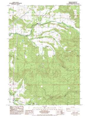
Jordan Topo Map Oregon
To zoom in, hover over the map of Jordan
USGS Topo Quad 44122f6 - 1:24,000 scale
| Topo Map Name: | Jordan |
| USGS Topo Quad ID: | 44122f6 |
| Print Size: | ca. 21 1/4" wide x 27" high |
| Southeast Coordinates: | 44.625° N latitude / 122.625° W longitude |
| Map Center Coordinates: | 44.6875° N latitude / 122.6875° W longitude |
| U.S. State: | OR |
| Filename: | o44122f6.jpg |
| Download Map JPG Image: | Jordan topo map 1:24,000 scale |
| Map Type: | Topographic |
| Topo Series: | 7.5´ |
| Map Scale: | 1:24,000 |
| Source of Map Images: | United States Geological Survey (USGS) |
| Alternate Map Versions: |
Jordan OR 1985, updated 1985 Download PDF Buy paper map Jordan OR 2011 Download PDF Buy paper map Jordan OR 2014 Download PDF Buy paper map |
1:24,000 Topo Quads surrounding Jordan
> Back to 44122e1 at 1:100,000 scale
> Back to 44122a1 at 1:250,000 scale
> Back to U.S. Topo Maps home
Jordan topo map: Gazetteer
Jordan: Bridges
Hannah Bridge elevation 134m 439′Jordan Bridge elevation 160m 524′
Larwood Bridge elevation 129m 423′
Jordan: Parks
Larwaood Wayside County Park elevation 146m 479′Roaring River County Park elevation 147m 482′
Jordan: Populated Places
Jordan elevation 165m 541′Jordan: Post Offices
Jordan Post Office (historical) elevation 165m 541′Larwood Post Office (historical) elevation 131m 429′
Jordan: Reservoirs
Bentz Ponds elevation 136m 446′Hafco Reservoir elevation 155m 508′
Larson Ponds elevation 193m 633′
Rogers Mountain Ranch Reservoir elevation 362m 1187′
Wilkes Reservoir elevation 467m 1532′
Ziebart Reservoir elevation 248m 813′
Zurfluhs Ponds elevation 303m 994′
Jordan: Streams
Bear Creek elevation 208m 682′Bilyeu Creek elevation 136m 446′
Blue Creek elevation 176m 577′
Burgen Creek elevation 134m 439′
Burmester Creek elevation 161m 528′
Craft Creek elevation 131m 429′
Jordan Creek elevation 160m 524′
Roaring River elevation 130m 426′
South Fork Neal Creek elevation 147m 482′
South Roaring River elevation 344m 1128′
Wildwood Creek elevation 168m 551′
Jordan: Summits
Prospect Mountain elevation 377m 1236′Rogers Mountain elevation 412m 1351′
Jordan: Valleys
Burgen Hollow elevation 133m 436′Jordan Valley elevation 158m 518′
Jordan digital topo map on disk
Buy this Jordan topo map showing relief, roads, GPS coordinates and other geographical features, as a high-resolution digital map file on DVD:


