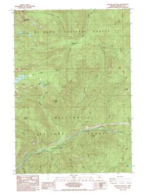
Mother Lode Mountain Topo Map Oregon
To zoom in, hover over the map of Mother Lode Mountain
USGS Topo Quad 44122g1 - 1:24,000 scale
| Topo Map Name: | Mother Lode Mountain |
| USGS Topo Quad ID: | 44122g1 |
| Print Size: | ca. 21 1/4" wide x 27" high |
| Southeast Coordinates: | 44.75° N latitude / 122° W longitude |
| Map Center Coordinates: | 44.8125° N latitude / 122.0625° W longitude |
| U.S. State: | OR |
| Filename: | o44122g1.jpg |
| Download Map JPG Image: | Mother Lode Mountain topo map 1:24,000 scale |
| Map Type: | Topographic |
| Topo Series: | 7.5´ |
| Map Scale: | 1:24,000 |
| Source of Map Images: | United States Geological Survey (USGS) |
| Alternate Map Versions: |
Mother Lode Mtn OR 1985, updated 1985 Download PDF Buy paper map Mother Lode Mtn OR 1994, updated 1998 Download PDF Buy paper map Mother Lode Mountain OR 2011 Download PDF Buy paper map Mother Lode Mountain OR 2014 Download PDF Buy paper map |
| FStopo: | US Forest Service topo Mother Lode Mountain is available: Download FStopo PDF Download FStopo TIF |
1:24,000 Topo Quads surrounding Mother Lode Mountain
> Back to 44122e1 at 1:100,000 scale
> Back to 44122a1 at 1:250,000 scale
> Back to U.S. Topo Maps home
Mother Lode Mountain topo map: Gazetteer
Mother Lode Mountain: Lakes
Dunlap Lake elevation 1156m 3792′Elk Lake elevation 1129m 3704′
Leone Lake elevation 1108m 3635′
Twin Lakes elevation 1194m 3917′
Mother Lode Mountain: Ridges
Janus Butte elevation 1396m 4580′Mother Lode Mountain: Streams
Battle Creek elevation 851m 2791′Byars Creek elevation 537m 1761′
Cliffs Creek elevation 543m 1781′
Cultus Creek elevation 581m 1906′
Deadhorse Creek elevation 539m 1768′
Dunlap Creek elevation 772m 2532′
East Humbug Creek elevation 609m 1998′
Fox Creek elevation 584m 1916′
Humbug Creek elevation 573m 1879′
Leone Creek elevation 638m 2093′
Mother Lode Creek elevation 874m 2867′
Scorpion Creek elevation 602m 1975′
Slide Creek elevation 536m 1758′
Wind Creek elevation 511m 1676′
Mother Lode Mountain: Summits
Deadhorse Mountain elevation 1479m 4852′Eagle Rock elevation 903m 2962′
Gold Butte elevation 1390m 4560′
Mother Lode Mountain elevation 1574m 5164′
Short Mountain elevation 1268m 4160′
Mother Lode Mountain: Swamps
Alder Swamp elevation 1345m 4412′Mother Lode Mountain: Trails
Elk Lake Trail elevation 822m 2696′Fox Creek Trail elevation 1177m 3861′
Humbug Ridge Trail elevation 1238m 4061′
Mother Lode Trail elevation 1233m 4045′
Scorpion Mountain Trail elevation 1187m 3894′
Scorpion Ridge Trail elevation 1094m 3589′
Twin Lakes Trail elevation 1207m 3959′
Welcome Lakes Ridge Trail elevation 1406m 4612′
Mother Lode Mountain digital topo map on disk
Buy this Mother Lode Mountain topo map showing relief, roads, GPS coordinates and other geographical features, as a high-resolution digital map file on DVD:


