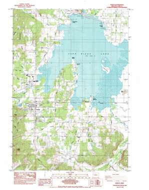
Veneta Topo Map Oregon
To zoom in, hover over the map of Veneta
USGS Topo Quad 44123a3 - 1:24,000 scale
| Topo Map Name: | Veneta |
| USGS Topo Quad ID: | 44123a3 |
| Print Size: | ca. 21 1/4" wide x 27" high |
| Southeast Coordinates: | 44° N latitude / 123.25° W longitude |
| Map Center Coordinates: | 44.0625° N latitude / 123.3125° W longitude |
| U.S. State: | OR |
| Filename: | o44123a3.jpg |
| Download Map JPG Image: | Veneta topo map 1:24,000 scale |
| Map Type: | Topographic |
| Topo Series: | 7.5´ |
| Map Scale: | 1:24,000 |
| Source of Map Images: | United States Geological Survey (USGS) |
| Alternate Map Versions: |
Elmira SE OR 1975, updated 1979 Download PDF Buy paper map Veneta OR 1984, updated 1984 Download PDF Buy paper map Veneta OR 2011 Download PDF Buy paper map Veneta OR 2014 Download PDF Buy paper map |
1:24,000 Topo Quads surrounding Veneta
> Back to 44123a1 at 1:100,000 scale
> Back to 44122a1 at 1:250,000 scale
> Back to U.S. Topo Maps home
Veneta topo map: Gazetteer
Veneta: Capes
Orchard Point elevation 116m 380′Perkins Peninsula elevation 118m 387′
Richardson Point elevation 115m 377′
Veneta: Dams
Fern Ridge Dam elevation 106m 347′Veneta: Guts
Warren Slough elevation 115m 377′Veneta: Islands
Gibson Island elevation 115m 377′Signal Island elevation 115m 377′
Veneta: Parks
Krugur Park elevation 115m 377′Oak Island Park elevation 133m 436′
Orchard Point County Park elevation 115m 377′
Perkins Peninsula County Park elevation 117m 383′
Richardson County Park elevation 115m 377′
Zumwalt County Park elevation 115m 377′
Veneta: Populated Places
Elmira elevation 118m 387′Fern Ridge Shores elevation 116m 380′
Veneta elevation 129m 423′
Veneta: Post Offices
Elmira Post Office elevation 118m 387′Llewellyn Post Office (historical) elevation 117m 383′
Veneta Post Office elevation 129m 423′
Veneta: Reservoirs
Davis Reservoir elevation 152m 498′Fern Ridge Lake elevation 106m 347′
Griffith Reservoir elevation 136m 446′
Veneta: Ridges
Demming Ridge elevation 212m 695′Fern Ridge elevation 122m 400′
Veneta: Streams
Coyote Creek elevation 115m 377′Hannavan Creek elevation 115m 377′
Indian Creek elevation 117m 383′
Inman Creek elevation 115m 377′
Job Swale Creek elevation 116m 380′
Middle Fork Coyote Creek elevation 116m 380′
Parker Creek elevation 125m 410′
Spencer Creek elevation 119m 390′
West Fork Coyote Creek elevation 116m 380′
Veneta: Summits
Bolton Hill elevation 252m 826′Fisher Butte elevation 135m 442′
Rocky Butte elevation 352m 1154′
Veneta digital topo map on disk
Buy this Veneta topo map showing relief, roads, GPS coordinates and other geographical features, as a high-resolution digital map file on DVD:


