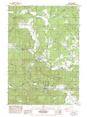
Noti Topo Map Oregon
To zoom in, hover over the map of Noti
USGS Topo Quad 44123a4 - 1:24,000 scale
| Topo Map Name: | Noti |
| USGS Topo Quad ID: | 44123a4 |
| Print Size: | ca. 21 1/4" wide x 27" high |
| Southeast Coordinates: | 44° N latitude / 123.375° W longitude |
| Map Center Coordinates: | 44.0625° N latitude / 123.4375° W longitude |
| U.S. State: | OR |
| Filename: | o44123a4.jpg |
| Download Map JPG Image: | Noti topo map 1:24,000 scale |
| Map Type: | Topographic |
| Topo Series: | 7.5´ |
| Map Scale: | 1:24,000 |
| Source of Map Images: | United States Geological Survey (USGS) |
| Alternate Map Versions: |
Noti OR 1984, updated 1984 Download PDF Buy paper map Noti OR 2011 Download PDF Buy paper map Noti OR 2014 Download PDF Buy paper map |
1:24,000 Topo Quads surrounding Noti
> Back to 44123a1 at 1:100,000 scale
> Back to 44122a1 at 1:250,000 scale
> Back to U.S. Topo Maps home
Noti topo map: Gazetteer
Noti: Airports
Crow-Mag Airfield elevation 129m 423′Noti: Dams
Forcia and Larsen Dam elevation 147m 482′Vaughn Log Dam elevation 154m 505′
Noti: Populated Places
Noti elevation 148m 485′Vaughn elevation 160m 524′
Noti: Post Offices
Berkley Post Office (historical) elevation 132m 433′Hale Post Office (historical) elevation 149m 488′
Ivison Post Office (historical) elevation 251m 823′
Long Tom Post Office (historical) elevation 120m 393′
Noti Post Office elevation 148m 485′
Varien Post Office (historical) elevation 152m 498′
Noti: Reservoirs
Forcia and Larsen Reservoir elevation 147m 482′Little Hahnee Reservoir elevation 166m 544′
Noti Creek Reservoir elevation 169m 554′
Noti: Ridges
Green Mountain elevation 362m 1187′Noti: Streams
Bolton Hill Creek elevation 120m 393′Cedar Creek elevation 157m 515′
Cram Creek elevation 153m 501′
Determination Creek elevation 148m 485′
Elk Creek elevation 129m 423′
Evans Creek elevation 140m 459′
Gold Run Creek elevation 134m 439′
Green Creek elevation 137m 449′
Hardy Creek elevation 153m 501′
Hayes Creek elevation 148m 485′
Hendricks Branch elevation 140m 459′
Hoselton Creek elevation 154m 505′
January Creek elevation 148m 485′
Jones Creek elevation 140m 459′
Langworthy Creek elevation 157m 515′
Mill Valley Creek elevation 143m 469′
Noel Creek elevation 156m 511′
Noti Creek elevation 129m 423′
Parsley Creek elevation 149m 488′
Poodle Creek elevation 129m 423′
Spring Creek elevation 154m 505′
Sweet Creek elevation 138m 452′
Warden Creek elevation 167m 547′
Wilson Creek elevation 120m 393′
Noti: Summits
Clay Hill elevation 260m 853′Stoney Point elevation 371m 1217′
Noti digital topo map on disk
Buy this Noti topo map showing relief, roads, GPS coordinates and other geographical features, as a high-resolution digital map file on DVD:


