Coburg Topo Map Oregon
To zoom in, hover over the map of Coburg
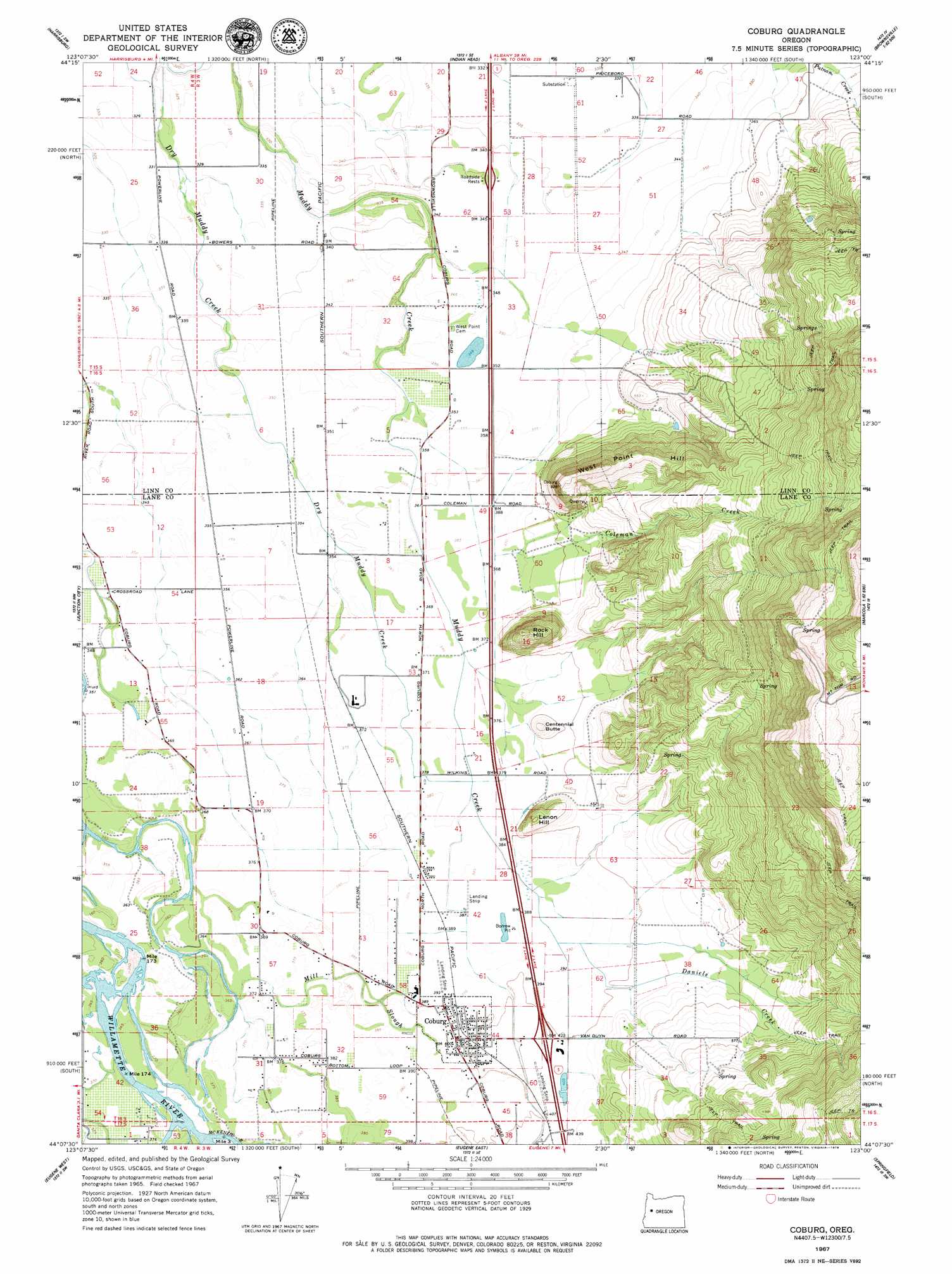
USGS Topo Quad 44123b1 - 1:24,000 scale
| Topo Map Name: | Coburg |
| USGS Topo Quad ID: | 44123b1 |
| Print Size: | ca. 21 1/4" wide x 27" high |
| Southeast Coordinates: | 44.125° N latitude / 123° W longitude |
| Map Center Coordinates: | 44.1875° N latitude / 123.0625° W longitude |
| U.S. State: | OR |
| Filename: | o44123b1.jpg |
| Download Map JPG Image: | Coburg topo map 1:24,000 scale |
| Map Type: | Topographic |
| Topo Series: | 7.5´ |
| Map Scale: | 1:24,000 |
| Source of Map Images: | United States Geological Survey (USGS) |
| Alternate Map Versions: |
Coburg OR 1967, updated 1969 Download PDF Buy paper map Coburg OR 2011 Download PDF Buy paper map Coburg OR 2014 Download PDF Buy paper map |
1:24,000 Topo Quads surrounding Coburg
Greenberry |
Peoria |
Halsey |
Brownsville |
Waterloo |
Monroe |
Harrisburg |
Indian Head |
Union Point |
Crawfordsville |
Cheshire |
Junction City |
Coburg |
Mohawk |
Marcola |
Veneta |
Eugene West |
Eugene East |
Springfield |
Walterville |
Crow |
Fox Hollow |
Creswell |
Jasper |
Lowell |
> Back to 44123a1 at 1:100,000 scale
> Back to 44122a1 at 1:250,000 scale
> Back to U.S. Topo Maps home
Coburg topo map: Gazetteer
Coburg: Airports
Briggs Airstrip elevation 119m 390′West Point Airport elevation 115m 377′
Coburg: Parks
Hileman Landing County Park elevation 112m 367′Norma Pfeiffer Park elevation 122m 400′
Coburg: Populated Places
Coburg elevation 122m 400′Coburg: Post Offices
Coburg Post Office elevation 122m 400′Palos Post Office (historical) elevation 107m 351′
Pine Post Office (historical) elevation 106m 347′
Coburg: Streams
Canterbury Creek elevation 110m 360′Cartwright Slough elevation 109m 357′
Coleman Creek elevation 112m 367′
Daniels Creek elevation 119m 390′
Dry Muddy Creek elevation 98m 321′
McKenzie River elevation 113m 370′
Mill Slough elevation 110m 360′
Coburg: Summits
Centennial Butte elevation 158m 518′Lenon Hill elevation 181m 593′
Rock Hill elevation 252m 826′
West Point Hill elevation 288m 944′
Coburg digital topo map on disk
Buy this Coburg topo map showing relief, roads, GPS coordinates and other geographical features, as a high-resolution digital map file on DVD: