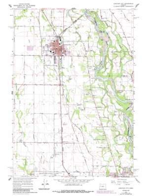
Junction City Topo Map Oregon
To zoom in, hover over the map of Junction City
USGS Topo Quad 44123b2 - 1:24,000 scale
| Topo Map Name: | Junction City |
| USGS Topo Quad ID: | 44123b2 |
| Print Size: | ca. 21 1/4" wide x 27" high |
| Southeast Coordinates: | 44.125° N latitude / 123.125° W longitude |
| Map Center Coordinates: | 44.1875° N latitude / 123.1875° W longitude |
| U.S. State: | OR |
| Filename: | o44123b2.jpg |
| Download Map JPG Image: | Junction City topo map 1:24,000 scale |
| Map Type: | Topographic |
| Topo Series: | 7.5´ |
| Map Scale: | 1:24,000 |
| Source of Map Images: | United States Geological Survey (USGS) |
| Alternate Map Versions: |
Junction City OR 1967, updated 1968 Download PDF Buy paper map Junction City OR 1967, updated 1969 Download PDF Buy paper map Junction City OR 1967, updated 1987 Download PDF Buy paper map Junction City OR 2011 Download PDF Buy paper map Junction City OR 2014 Download PDF Buy paper map |
1:24,000 Topo Quads surrounding Junction City
> Back to 44123a1 at 1:100,000 scale
> Back to 44122a1 at 1:250,000 scale
> Back to U.S. Topo Maps home
Junction City topo map: Gazetteer
Junction City: Airports
Ayres Airstrip elevation 97m 318′Junction City: Bars
Bells Shute Bar elevation 105m 344′Horseshoe Bar elevation 96m 314′
Junction City: Bends
Harpers Bend elevation 96m 314′Harrisburg Bend elevation 93m 305′
Wilson Bend elevation 106m 347′
Junction City: Islands
Marshall Island elevation 105m 344′Junction City: Lakes
Bryant Lake elevation 102m 334′Love Lake elevation 99m 324′
Junction City: Parks
Awbrey City Park elevation 114m 374′Bailey Park elevation 100m 328′
Bergstrom Park elevation 100m 328′
Browns Landing State Park elevation 103m 337′
Christensen Landing Park elevation 105m 344′
Day Memorial Park elevation 100m 328′
Laurel Park elevation 97m 318′
Washburne Park elevation 100m 328′
Junction City: Populated Places
Junction City elevation 100m 328′Junction City: Post Offices
Grand Prairie Post Office (historical) elevation 108m 354′Junction City Post Office elevation 100m 328′
Junction City: Streams
Crow Creek elevation 104m 341′Curtis Slough elevation 93m 305′
Marshall Slough elevation 105m 344′
Pondertex Creek elevation 98m 321′
Spring Creek elevation 105m 344′
Spring Creek elevation 99m 324′
Third Slough elevation 99m 324′
Junction City digital topo map on disk
Buy this Junction City topo map showing relief, roads, GPS coordinates and other geographical features, as a high-resolution digital map file on DVD:


