Indian Head Topo Map Oregon
To zoom in, hover over the map of Indian Head
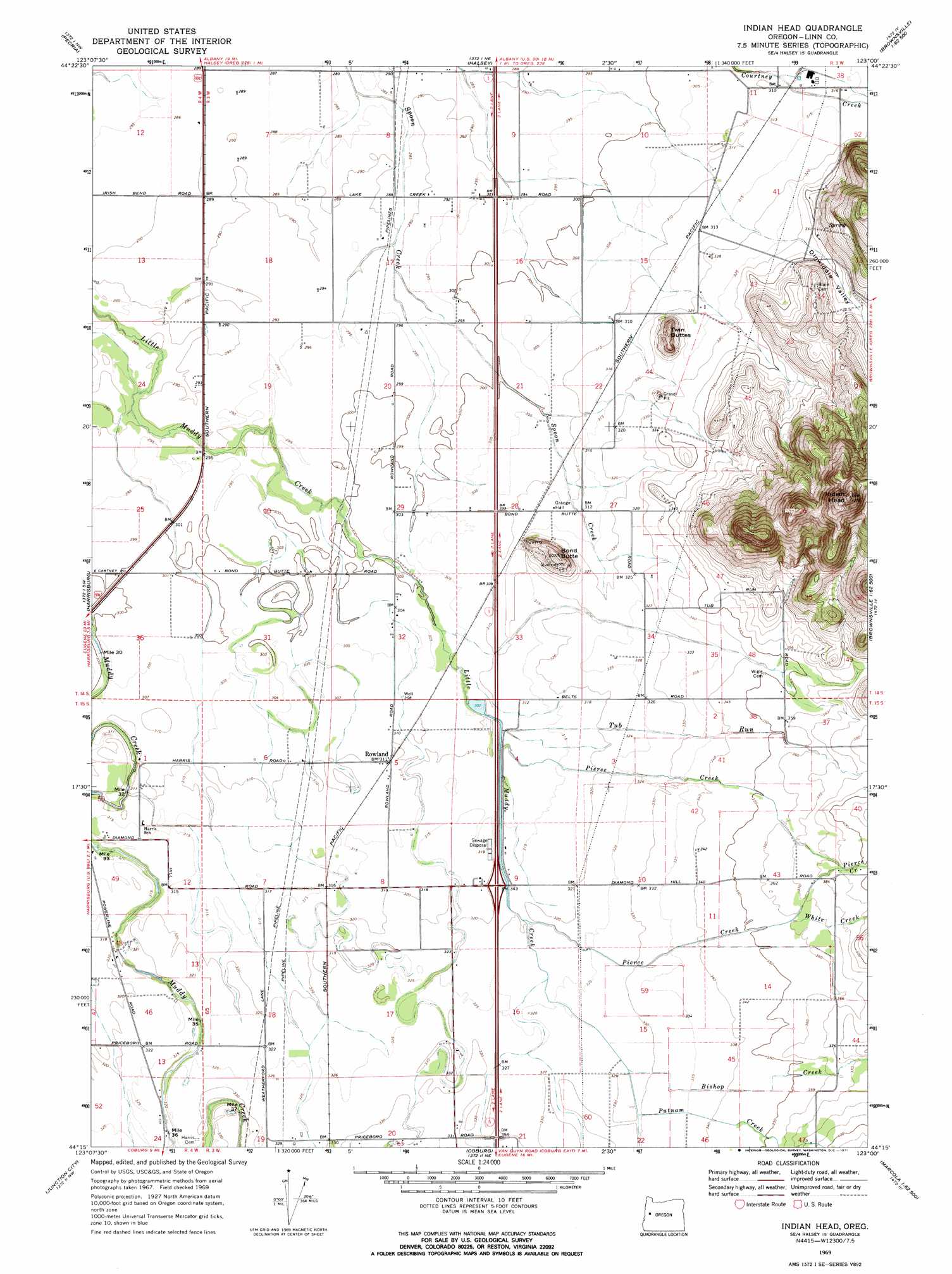
USGS Topo Quad 44123c1 - 1:24,000 scale
| Topo Map Name: | Indian Head |
| USGS Topo Quad ID: | 44123c1 |
| Print Size: | ca. 21 1/4" wide x 27" high |
| Southeast Coordinates: | 44.25° N latitude / 123° W longitude |
| Map Center Coordinates: | 44.3125° N latitude / 123.0625° W longitude |
| U.S. State: | OR |
| Filename: | o44123c1.jpg |
| Download Map JPG Image: | Indian Head topo map 1:24,000 scale |
| Map Type: | Topographic |
| Topo Series: | 7.5´ |
| Map Scale: | 1:24,000 |
| Source of Map Images: | United States Geological Survey (USGS) |
| Alternate Map Versions: |
Indian Head OR 1969, updated 1971 Download PDF Buy paper map Indian Head OR 1969, updated 1971 Download PDF Buy paper map Indian Head OR 2011 Download PDF Buy paper map Indian Head OR 2014 Download PDF Buy paper map |
1:24,000 Topo Quads surrounding Indian Head
Corvallis |
Riverside |
Tangent |
Lebanon |
Onehorse Slough |
Greenberry |
Peoria |
Halsey |
Brownsville |
Waterloo |
Monroe |
Harrisburg |
Indian Head |
Union Point |
Crawfordsville |
Cheshire |
Junction City |
Coburg |
Mohawk |
Marcola |
Veneta |
Eugene West |
Eugene East |
Springfield |
Walterville |
> Back to 44123a1 at 1:100,000 scale
> Back to 44122a1 at 1:250,000 scale
> Back to U.S. Topo Maps home
Indian Head topo map: Gazetteer
Indian Head: Airports
Daniels Field elevation 99m 324′Lafferty Field elevation 112m 367′
Wrights Airfield elevation 110m 360′
Indian Head: Post Offices
Rowland Post Office (historical) elevation 96m 314′Indian Head: Reservoirs
Permaneer Log Pond elevation 96m 314′Indian Head: Streams
Bishop Creek elevation 101m 331′Pierce Creek elevation 97m 318′
Pierce Creek elevation 94m 308′
Putnam Creek elevation 102m 334′
Tub Run elevation 96m 314′
White Creek elevation 110m 360′
Indian Head: Summits
Bond Butte elevation 136m 446′Indian Head elevation 375m 1230′
Twin Buttes elevation 144m 472′
Indian Head: Valleys
Dinwiddie Valley elevation 100m 328′Indian Head digital topo map on disk
Buy this Indian Head topo map showing relief, roads, GPS coordinates and other geographical features, as a high-resolution digital map file on DVD: