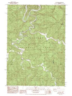
Five Rivers Topo Map Oregon
To zoom in, hover over the map of Five Rivers
USGS Topo Quad 44123c7 - 1:24,000 scale
| Topo Map Name: | Five Rivers |
| USGS Topo Quad ID: | 44123c7 |
| Print Size: | ca. 21 1/4" wide x 27" high |
| Southeast Coordinates: | 44.25° N latitude / 123.75° W longitude |
| Map Center Coordinates: | 44.3125° N latitude / 123.8125° W longitude |
| U.S. State: | OR |
| Filename: | o44123c7.jpg |
| Download Map JPG Image: | Five Rivers topo map 1:24,000 scale |
| Map Type: | Topographic |
| Topo Series: | 7.5´ |
| Map Scale: | 1:24,000 |
| Source of Map Images: | United States Geological Survey (USGS) |
| Alternate Map Versions: |
Five Rivers OR 1984, updated 1985 Download PDF Buy paper map Five Rivers OR 2011 Download PDF Buy paper map Five Rivers OR 2014 Download PDF Buy paper map |
| FStopo: | US Forest Service topo Five Rivers is available: Download FStopo PDF Download FStopo TIF |
1:24,000 Topo Quads surrounding Five Rivers
> Back to 44123a1 at 1:100,000 scale
> Back to 44122a1 at 1:250,000 scale
> Back to U.S. Topo Maps home
Five Rivers topo map: Gazetteer
Five Rivers: Capes
Stoney Point elevation 35m 114′Five Rivers: Falls
Cascade Falls elevation 65m 213′Five Rivers: Parks
Five Rivers County Launch elevation 47m 154′National Forest Land Park elevation 54m 177′
Five Rivers: Populated Places
Denzer (historical) elevation 65m 213′Fisher elevation 69m 226′
Paris elevation 94m 308′
Five Rivers: Post Offices
Denzer Post Office (historical) elevation 65m 213′Fisher Post Office (historical) elevation 69m 226′
Paris Post Office (historical) elevation 94m 308′
Vernon Post Office (historical) elevation 42m 137′
Five Rivers: Ridges
Denzer Ridge elevation 313m 1026′Fleece Ridge elevation 276m 905′
Pitchfork Ridge elevation 326m 1069′
Five Rivers: Streams
Alder Creek elevation 71m 232′Bear Creek elevation 65m 213′
Buck Creek elevation 63m 206′
Camp Creek elevation 50m 164′
Cascade Creek elevation 51m 167′
Cedar Creek elevation 85m 278′
Cherry Creek elevation 71m 232′
Cougar Creek elevation 62m 203′
Crab Creek elevation 67m 219′
Crazy Creek elevation 78m 255′
Crooked Creek elevation 49m 160′
Elk Creek elevation 38m 124′
Fendall Creek elevation 80m 262′
Five Rivers elevation 34m 111′
George Creek elevation 118m 387′
Green River elevation 78m 255′
Hoover Creek elevation 141m 462′
Lake Creek elevation 140m 459′
Lobster Creek elevation 39m 127′
McDonald Creek elevation 70m 229′
McGlynn Creek elevation 49m 160′
Meadow Fork elevation 80m 262′
North Fork Cascade Creek elevation 106m 347′
Phillips Creek elevation 51m 167′
Ryan Creek elevation 87m 285′
Summers Creek elevation 93m 305′
Swamp Creek elevation 59m 193′
Taylor Creek elevation 49m 160′
Five Rivers digital topo map on disk
Buy this Five Rivers topo map showing relief, roads, GPS coordinates and other geographical features, as a high-resolution digital map file on DVD:


