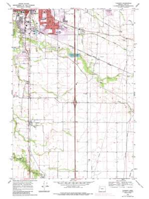
Tangent Topo Map Oregon
To zoom in, hover over the map of Tangent
USGS Topo Quad 44123e1 - 1:24,000 scale
| Topo Map Name: | Tangent |
| USGS Topo Quad ID: | 44123e1 |
| Print Size: | ca. 21 1/4" wide x 27" high |
| Southeast Coordinates: | 44.5° N latitude / 123° W longitude |
| Map Center Coordinates: | 44.5625° N latitude / 123.0625° W longitude |
| U.S. State: | OR |
| Filename: | o44123e1.jpg |
| Download Map JPG Image: | Tangent topo map 1:24,000 scale |
| Map Type: | Topographic |
| Topo Series: | 7.5´ |
| Map Scale: | 1:24,000 |
| Source of Map Images: | United States Geological Survey (USGS) |
| Alternate Map Versions: |
Tangent OR 1969, updated 1971 Download PDF Buy paper map Tangent OR 1969, updated 1978 Download PDF Buy paper map Tangent OR 1969, updated 1987 Download PDF Buy paper map Tangent OR 2011 Download PDF Buy paper map Tangent OR 2014 Download PDF Buy paper map |
1:24,000 Topo Quads surrounding Tangent
> Back to 44123e1 at 1:100,000 scale
> Back to 44122a1 at 1:250,000 scale
> Back to U.S. Topo Maps home
Tangent topo map: Gazetteer
Tangent: Airports
Grells Airfield elevation 78m 255′Miller Airstrip elevation 85m 278′
Roppair Airfield elevation 76m 249′
Tangent: Canals
Albany Santiam Canal elevation 79m 259′Tangent: Lakes
Muddys Pond elevation 73m 239′Tangent: Parks
Draper Park elevation 70m 229′Freeway Lakes County Park elevation 71m 232′
Sunrise Park elevation 71m 232′
Tangent: Populated Places
Tangent elevation 76m 249′Tangent: Post Offices
Tangent Post Office elevation 76m 249′Tangent: Streams
Little Oak Creek elevation 77m 252′Shedd Slough elevation 70m 229′
Tangent digital topo map on disk
Buy this Tangent topo map showing relief, roads, GPS coordinates and other geographical features, as a high-resolution digital map file on DVD:


