Summit Topo Map Oregon
To zoom in, hover over the map of Summit
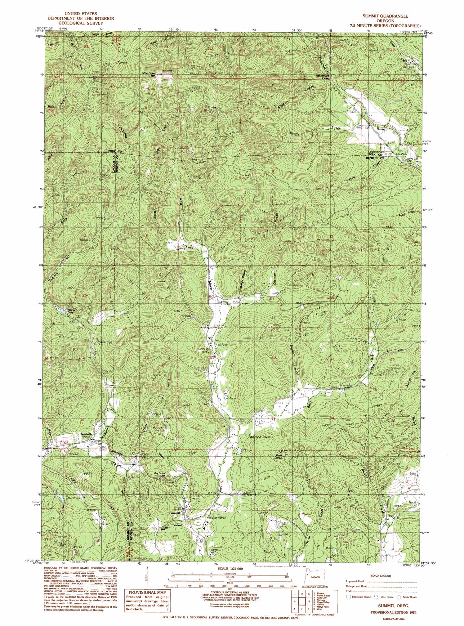
USGS Topo Quad 44123f5 - 1:24,000 scale
| Topo Map Name: | Summit |
| USGS Topo Quad ID: | 44123f5 |
| Print Size: | ca. 21 1/4" wide x 27" high |
| Southeast Coordinates: | 44.625° N latitude / 123.5° W longitude |
| Map Center Coordinates: | 44.6875° N latitude / 123.5625° W longitude |
| U.S. State: | OR |
| Filename: | o44123f5.jpg |
| Download Map JPG Image: | Summit topo map 1:24,000 scale |
| Map Type: | Topographic |
| Topo Series: | 7.5´ |
| Map Scale: | 1:24,000 |
| Source of Map Images: | United States Geological Survey (USGS) |
| Alternate Map Versions: |
Summit OR 1984, updated 1984 Download PDF Buy paper map Summit OR 2011 Download PDF Buy paper map Summit OR 2014 Download PDF Buy paper map |
1:24,000 Topo Quads surrounding Summit
Stott Mountain |
Warnicke Creek |
Laurel Mountain |
Socialist Valley |
Dallas |
Euchre Mountain |
Valsetz |
Fanno Ridge |
Falls City |
Airlie North |
Eddyville |
Nortons |
Summit |
Kings Valley |
Airlie South |
Elk City |
Harlan |
Marys Peak |
Wren |
Corvallis |
Hellion Rapids |
Grass Mountain |
Alsea |
Flat Mountain |
Greenberry |
> Back to 44123e1 at 1:100,000 scale
> Back to 44122a1 at 1:250,000 scale
> Back to U.S. Topo Maps home
Summit topo map: Gazetteer
Summit: Populated Places
Nashville elevation 73m 239′Summit elevation 223m 731′
Summit: Post Offices
Nashville Post Office (historical) elevation 73m 239′Summit Post Office (historical) elevation 223m 731′
Summit: Reservoirs
Hamar Lake elevation 133m 436′Summit: Springs
Strout Spring elevation 274m 898′Summit: Streams
Bailey Creek elevation 245m 803′Bottger Creek elevation 208m 682′
Burchard Creek elevation 206m 675′
East Fork Marys River elevation 201m 659′
Happy Hollow Creek elevation 197m 646′
Harris Creek elevation 123m 403′
Humphrey Creek elevation 71m 232′
Kopplein Creek elevation 119m 390′
Little Yaquina River elevation 89m 291′
Oleman Creek elevation 208m 682′
Shingle Creek elevation 207m 679′
Slide Creek elevation 130m 426′
Spilde Creek elevation 73m 239′
West Fork Marys River elevation 201m 659′
Summit: Summits
Goat Knob elevation 367m 1204′Little Grass Mountain elevation 810m 2657′
Summit: Valleys
Granite Canyon elevation 227m 744′Happy Hollow elevation 207m 679′
Summit digital topo map on disk
Buy this Summit topo map showing relief, roads, GPS coordinates and other geographical features, as a high-resolution digital map file on DVD: