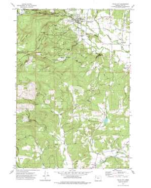
Falls City Topo Map Oregon
To zoom in, hover over the map of Falls City
USGS Topo Quad 44123g4 - 1:24,000 scale
| Topo Map Name: | Falls City |
| USGS Topo Quad ID: | 44123g4 |
| Print Size: | ca. 21 1/4" wide x 27" high |
| Southeast Coordinates: | 44.75° N latitude / 123.375° W longitude |
| Map Center Coordinates: | 44.8125° N latitude / 123.4375° W longitude |
| U.S. State: | OR |
| Filename: | o44123g4.jpg |
| Download Map JPG Image: | Falls City topo map 1:24,000 scale |
| Map Type: | Topographic |
| Topo Series: | 7.5´ |
| Map Scale: | 1:24,000 |
| Source of Map Images: | United States Geological Survey (USGS) |
| Alternate Map Versions: |
Falls City OR 1974, updated 1977 Download PDF Buy paper map Falls City OR 2011 Download PDF Buy paper map Falls City OR 2014 Download PDF Buy paper map |
1:24,000 Topo Quads surrounding Falls City
> Back to 44123e1 at 1:100,000 scale
> Back to 44122a1 at 1:250,000 scale
> Back to U.S. Topo Maps home
Falls City topo map: Gazetteer
Falls City: Falls
Berry Creek Falls elevation 326m 1069′Falls City: Parks
Bridge Park elevation 120m 393′Fran Wilson Riverside Park elevation 111m 364′
George Kitchen Upper Park elevation 156m 511′
Gerlinger County Park elevation 156m 511′
Michael Harding Park elevation 125m 410′
Falls City: Populated Places
Black Rock elevation 218m 715′Bridgeport elevation 85m 278′
Carey (historical) elevation 99m 324′
Falls City elevation 112m 367′
Pedee elevation 84m 275′
Falls City: Post Offices
Black Rock Post Office (historical) elevation 218m 715′Falls City Post Office elevation 112m 367′
Pedee Post Office (historical) elevation 84m 275′
Falls City: Reservoirs
Falls City Reservoir elevation 203m 666′Frink Reservoir elevation 113m 370′
Jahn Reservoir elevation 360m 1181′
Maddux Reservoir elevation 87m 285′
Morgan Reservoir elevation 242m 793′
Steen Reservoir elevation 142m 465′
Falls City: Springs
Rattling Springs elevation 235m 770′Teal Spring elevation 218m 715′
Falls City: Streams
Berry Creek elevation 132m 433′Boughey Creek elevation 103m 337′
Dutch Creek elevation 132m 433′
Everz Creek elevation 110m 360′
Glaze Creek elevation 232m 761′
Grant Creek elevation 88m 288′
Link Creek elevation 75m 246′
McTimmonds Creek elevation 73m 239′
North Fork Pedee Creek elevation 105m 344′
North Fork Teal Creek elevation 349m 1145′
Sams Creek elevation 207m 679′
South Fork Pedee Creek elevation 105m 344′
South Fork Teal Creek elevation 349m 1145′
Teal Creek elevation 78m 255′
Waymire Creek elevation 91m 298′
Falls City: Summits
Mount Sykes elevation 613m 2011′Tater Hill elevation 334m 1095′
Falls City: Valleys
McTimmonds Valley elevation 95m 311′Falls City digital topo map on disk
Buy this Falls City topo map showing relief, roads, GPS coordinates and other geographical features, as a high-resolution digital map file on DVD:


