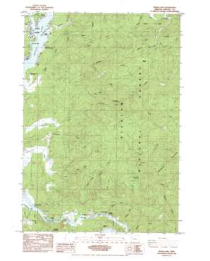
Devils Lake Topo Map Oregon
To zoom in, hover over the map of Devils Lake
USGS Topo Quad 44123h8 - 1:24,000 scale
| Topo Map Name: | Devils Lake |
| USGS Topo Quad ID: | 44123h8 |
| Print Size: | ca. 21 1/4" wide x 27" high |
| Southeast Coordinates: | 44.875° N latitude / 123.875° W longitude |
| Map Center Coordinates: | 44.9375° N latitude / 123.9375° W longitude |
| U.S. State: | OR |
| Filename: | o44123h8.jpg |
| Download Map JPG Image: | Devils Lake topo map 1:24,000 scale |
| Map Type: | Topographic |
| Topo Series: | 7.5´ |
| Map Scale: | 1:24,000 |
| Source of Map Images: | United States Geological Survey (USGS) |
| Alternate Map Versions: |
Devils Lake OR 1984, updated 1984 Download PDF Buy paper map Devils Lake OR 2011 Download PDF Buy paper map Devils Lake OR 2014 Download PDF Buy paper map |
| FStopo: | US Forest Service topo Devils Lake is available: Download FStopo PDF Download FStopo TIF |
1:24,000 Topo Quads surrounding Devils Lake
> Back to 44123e1 at 1:100,000 scale
> Back to 44122a1 at 1:250,000 scale
> Back to U.S. Topo Maps home
Devils Lake topo map: Gazetteer
Devils Lake: Airports
North Lincoln Hospital Heliport elevation 18m 59′Devils Lake: Bends
Chinook Bend elevation 5m 16′The Loop elevation 82m 269′
Devils Lake: Bridges
Drift Creek Bridge (historical) elevation 61m 200′Devils Lake: Capes
Lake Point elevation 10m 32′Devils Lake: Dams
Oceanlake Dam elevation 133m 436′Devils Lake: Falls
Echo Falls elevation 32m 104′Devils Lake: Flats
Elos Prairie elevation 255m 836′Devils Lake: Parks
Drift Creek County Park elevation 13m 42′Regatta Park elevation 9m 29′
Devils Lake: Pillars
Coyote Rock elevation 9m 29′Medicine Rock elevation 141m 462′
Devils Lake: Reservoirs
Reed Reservoir elevation 28m 91′Devils Lake: Ridges
Deadwood Mountain elevation 361m 1184′Devils Lake: Streams
Abrams Creek elevation 4m 13′Anderson Creek elevation 6m 19′
Barhaven Creek elevation 5m 16′
Bear Creek elevation 6m 19′
Bluff Creek elevation 8m 26′
Bones Creek elevation 6m 19′
Callow Creek elevation 86m 282′
East Fork Quarry Creek elevation 137m 449′
Erickson Creek elevation 41m 134′
Fall Creek elevation 75m 246′
Gordey Creek elevation 7m 22′
North Creek elevation 81m 265′
North Fork Schooner Creek elevation 118m 387′
Odell Creek elevation 62m 203′
Quarry Creek elevation 55m 180′
Skunk Creek elevation 8m 26′
South Fork Schooner Creek elevation 118m 387′
Southman Creek elevation 80m 262′
Tarry Creek elevation 88m 288′
Thompson Creek elevation 3m 9′
Wildcat Creek elevation 133m 436′
Wildcat Creek elevation 5m 16′
Devils Lake: Summits
Ball Mountain elevation 563m 1847′Cannery Mountain elevation 302m 990′
Prairie Hill elevation 437m 1433′
Devils Lake: Trails
Drift Creek Trail elevation 164m 538′Devils Lake digital topo map on disk
Buy this Devils Lake topo map showing relief, roads, GPS coordinates and other geographical features, as a high-resolution digital map file on DVD:


