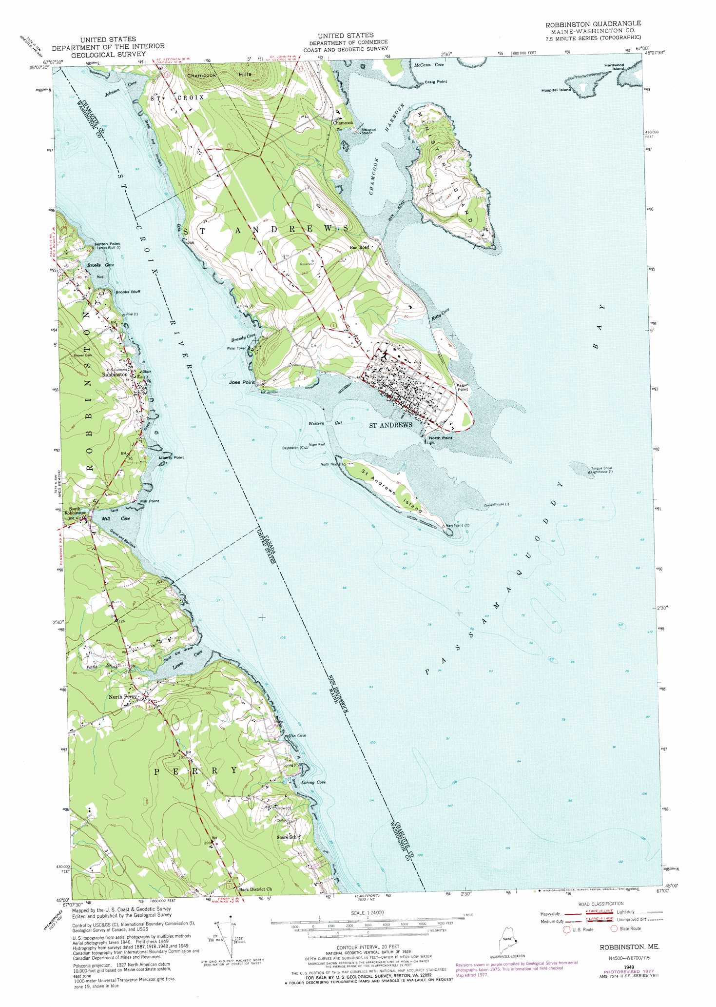
Robbinston Topo Map Maine
To zoom in, hover over the map of Robbinston
USGS Topo Quad 45067a1 - 1:24,000 scale
| Topo Map Name: | Robbinston |
| USGS Topo Quad ID: | 45067a1 |
| Print Size: | ca. 21 1/4" wide x 27" high |
| Southeast Coordinates: | 45° N latitude / 67° W longitude |
| Map Center Coordinates: | 45.0625° N latitude / 67.0625° W longitude |
| U.S. State: | ME |
| Filename: | o45067a1.jpg |
| Download Map JPG Image: | Robbinston topo map 1:24,000 scale |
| Map Type: | Topographic |
| Topo Series: | 7.5´ |
| Map Scale: | 1:24,000 |
| Source of Map Images: | United States Geological Survey (USGS) |
| Alternate Map Versions: |
Robbinston ME 1949, updated 1952 Download PDF Buy paper map Robbinston ME 1949, updated 1966 Download PDF Buy paper map Robbinston ME 1949, updated 1978 Download PDF Buy paper map Robbinston ME 2011 Download PDF Buy paper map Robbinston ME 2014 Download PDF Buy paper map |
1:24,000 Topo Quads surrounding Robbinston
Calais |
||||
Devils Head |
Meddybemp Lake East |
Red Beach |
||
Robbinston |
Porcupine Mountain |
Pembroke |
Eastport |
|
Long Lake |
Whiting |
West Lubec |
Lubec |
> Back to 45067a1 at 1:100,000 scale
> Back to 45066a1 at 1:250,000 scale
> Back to U.S. Topo Maps home
Robbinston topo map: Gazetteer
Robbinston: Bays
Brooks Cove elevation 2m 6′Gin Cove elevation 6m 19′
Lewis Cove elevation 0m 0′
Loring Cove elevation 0m 0′
Mill Cove elevation 0m 0′
Passamaquoddy Bay elevation 0m 0′
Robbinston: Capes
Hinton Point elevation 18m 59′Liberty Point elevation 1m 3′
Mill Point elevation 6m 19′
Robbinston: Cliffs
Brooks Bluff elevation 14m 45′Robbinston: Populated Places
North Perry elevation 24m 78′Robbinston elevation 20m 65′
South Robbinston elevation 16m 52′
Robbinston: Streams
Pottle Brook elevation 0m 0′Saint Croix River elevation 0m 0′
Western Stream elevation 8m 26′
Robbinston digital topo map on disk
Buy this Robbinston topo map showing relief, roads, GPS coordinates and other geographical features, as a high-resolution digital map file on DVD:
Maine, New Hampshire, Rhode Island & Eastern Massachusetts
Buy digital topo maps: Maine, New Hampshire, Rhode Island & Eastern Massachusetts