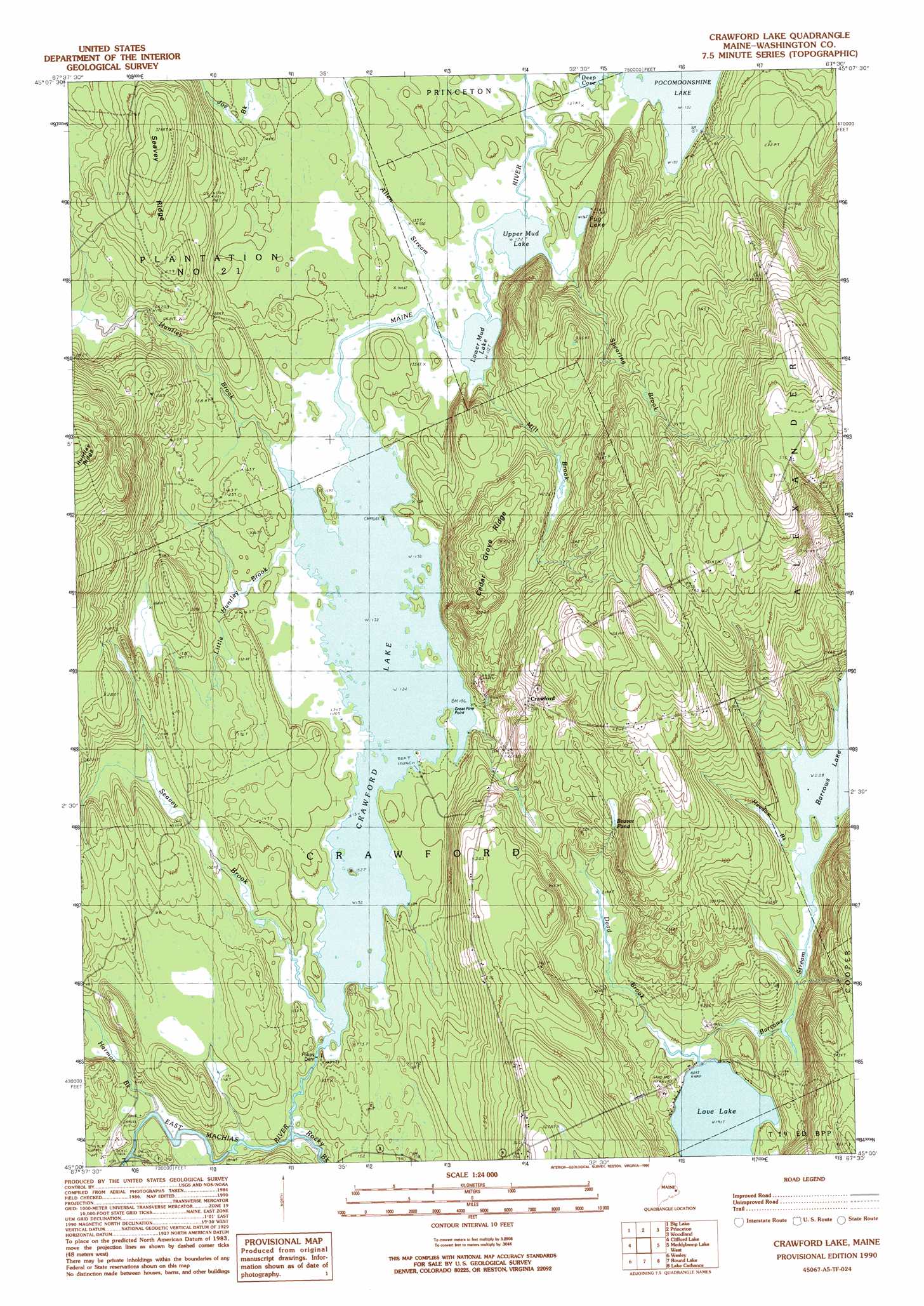
Crawford Lake Topo Map Maine
To zoom in, hover over the map of Crawford Lake
USGS Topo Quad 45067a5 - 1:24,000 scale
| Topo Map Name: | Crawford Lake |
| USGS Topo Quad ID: | 45067a5 |
| Print Size: | ca. 21 1/4" wide x 27" high |
| Southeast Coordinates: | 45° N latitude / 67.5° W longitude |
| Map Center Coordinates: | 45.0625° N latitude / 67.5625° W longitude |
| U.S. State: | ME |
| Filename: | o45067a5.jpg |
| Download Map JPG Image: | Crawford Lake topo map 1:24,000 scale |
| Map Type: | Topographic |
| Topo Series: | 7.5´ |
| Map Scale: | 1:24,000 |
| Source of Map Images: | United States Geological Survey (USGS) |
| Alternate Map Versions: |
Crawford Lake ME 1990, updated 1990 Download PDF Buy paper map Crawford Lake ME 2011 Download PDF Buy paper map Crawford Lake ME 2014 Download PDF Buy paper map |
1:24,000 Topo Quads surrounding Crawford Lake
Oxbrook Lakes |
Waite |
Toman Ridge |
Kellyland |
|
Grand Lake Stream |
Big Lake |
Princeton |
Woodland |
Calais |
Monroe Lake |
Clifford Lake |
Crawford Lake |
Meddybemp Lake West |
Meddybemp Lake East |
Tug Mountain |
Wesley |
Round Lake |
Lake Cathance |
Porcupine Mountain |
Montegail Pond |
Peaked Mountain Pond |
Bog Lake |
Hadley Lake |
Long Lake |
> Back to 45067a1 at 1:100,000 scale
> Back to 45066a1 at 1:250,000 scale
> Back to U.S. Topo Maps home
Crawford Lake topo map: Gazetteer
Crawford Lake: Capes
Great Pine Point elevation 42m 137′Crawford Lake: Dams
Barrows Lake Dam elevation 67m 219′Pokey Dam elevation 40m 131′
Crawford Lake: Lakes
Barrows Lake elevation 68m 223′Beaver Pond elevation 96m 314′
Lower Mud Lake elevation 40m 131′
Pug Lake elevation 41m 134′
Upper Mud Lake elevation 40m 131′
Crawford Lake: Populated Places
Crawford elevation 87m 285′Crawford Lake: Reservoirs
Crawford Lake elevation 40m 131′Crawford Lake: Ridges
Cedar Grove Ridge elevation 103m 337′Seavey Ridge elevation 104m 341′
Crawford Lake: Streams
Allen Stream elevation 40m 131′Barrows Stream elevation 58m 190′
Dead Brook elevation 59m 193′
Harmon Brook elevation 32m 104′
Huntley Brook elevation 63m 206′
Little Huntley Brook elevation 40m 131′
Maine River elevation 40m 131′
Meadow Brook elevation 68m 223′
Mill Brook elevation 40m 131′
Seavey Brook elevation 41m 134′
Spearing Brook elevation 40m 131′
Crawford Lake digital topo map on disk
Buy this Crawford Lake topo map showing relief, roads, GPS coordinates and other geographical features, as a high-resolution digital map file on DVD:
Maine, New Hampshire, Rhode Island & Eastern Massachusetts
Buy digital topo maps: Maine, New Hampshire, Rhode Island & Eastern Massachusetts