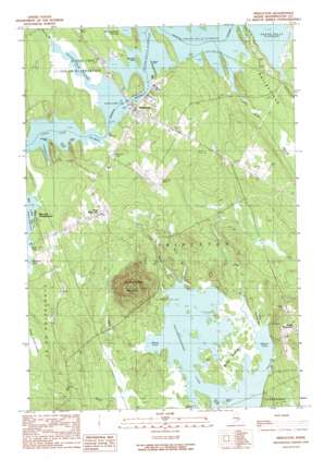
Princeton Topo Map Maine
To zoom in, hover over the map of Princeton
USGS Topo Quad 45067b5 - 1:24,000 scale
| Topo Map Name: | Princeton |
| USGS Topo Quad ID: | 45067b5 |
| Print Size: | ca. 21 1/4" wide x 27" high |
| Southeast Coordinates: | 45.125° N latitude / 67.5° W longitude |
| Map Center Coordinates: | 45.1875° N latitude / 67.5625° W longitude |
| U.S. State: | ME |
| Filename: | o45067b5.jpg |
| Download Map JPG Image: | Princeton topo map 1:24,000 scale |
| Map Type: | Topographic |
| Topo Series: | 7.5´ |
| Map Scale: | 1:24,000 |
| Source of Map Images: | United States Geological Survey (USGS) |
| Alternate Map Versions: |
Princeton ME 1990, updated 1990 Download PDF Buy paper map Princeton ME 2011 Download PDF Buy paper map Princeton ME 2014 Download PDF Buy paper map |
1:24,000 Topo Quads surrounding Princeton
> Back to 45067a1 at 1:100,000 scale
> Back to 45066a1 at 1:250,000 scale
> Back to U.S. Topo Maps home
Princeton topo map: Gazetteer
Princeton: Airports
Princeton Municipal Airport elevation 74m 242′Princeton: Basins
The Basin elevation 61m 200′Princeton: Bays
Black Cove elevation 40m 131′Blood Cove elevation 40m 131′
Brown Cove elevation 40m 131′
Deep Cove elevation 40m 131′
Greenland Cove elevation 64m 209′
Jameson Cove elevation 62m 203′
Rolfe Cove elevation 61m 200′
Sand Cove elevation 61m 200′
Princeton: Beaches
Hold Shore elevation 63m 206′Princeton: Capes
Greenland Point elevation 61m 200′Morrison Point elevation 40m 131′
Second Point elevation 65m 213′
Tierney Point elevation 61m 200′
Princeton: Channels
The Narrows elevation 61m 200′Princeton: Islands
Black Bird Island elevation 62m 203′Princeton: Lakes
Lewy Lake elevation 61m 200′Long Lake elevation 61m 200′
Pocomoonshine Lake elevation 40m 131′
Princeton: Populated Places
Princeton elevation 65m 213′South Princeton elevation 108m 354′
West Princeton elevation 74m 242′
Princeton: Post Offices
Princeton Post Office elevation 62m 203′Princeton: Streams
Dog Brook elevation 40m 131′Huntley Brook elevation 61m 200′
Joe Brook elevation 39m 127′
Lewys Brook elevation 40m 131′
Pudding Brook elevation 61m 200′
Rocky Brook elevation 46m 150′
Slime Meadow Brook elevation 40m 131′
Princeton: Summits
Pocomoonshine Mountain elevation 186m 610′Princeton: Swamps
Middle Ground elevation 42m 137′Sawtelle Heath elevation 64m 209′
Princeton digital topo map on disk
Buy this Princeton topo map showing relief, roads, GPS coordinates and other geographical features, as a high-resolution digital map file on DVD:
Maine, New Hampshire, Rhode Island & Eastern Massachusetts
Buy digital topo maps: Maine, New Hampshire, Rhode Island & Eastern Massachusetts


