Kellyland Topo Map Maine
To zoom in, hover over the map of Kellyland
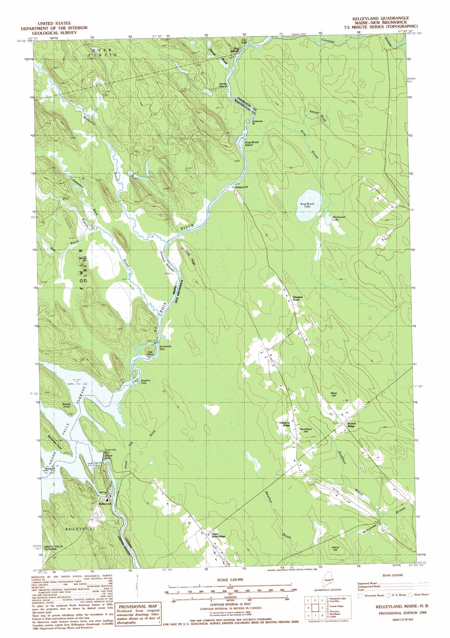
USGS Topo Quad 45067c4 - 1:24,000 scale
| Topo Map Name: | Kellyland |
| USGS Topo Quad ID: | 45067c4 |
| Print Size: | ca. 21 1/4" wide x 27" high |
| Southeast Coordinates: | 45.25° N latitude / 67.375° W longitude |
| Map Center Coordinates: | 45.3125° N latitude / 67.4375° W longitude |
| U.S. State: | ME |
| Filename: | o45067c4.jpg |
| Download Map JPG Image: | Kellyland topo map 1:24,000 scale |
| Map Type: | Topographic |
| Topo Series: | 7.5´ |
| Map Scale: | 1:24,000 |
| Source of Map Images: | United States Geological Survey (USGS) |
| Alternate Map Versions: |
Kelleyland ME 1988, updated 1988 Download PDF Buy paper map Kelleyland ME 2011 Download PDF Buy paper map Kelleyland ME 2014 Download PDF Buy paper map |
1:24,000 Topo Quads surrounding Kellyland
Forest |
Lambert Lake |
Vanceboro |
||
Tomah Mountain |
Simsquish Lake |
Loon Bay |
||
Waite |
Toman Ridge |
Kellyland |
||
Big Lake |
Princeton |
Woodland |
Calais |
Devils Head |
Clifford Lake |
Crawford Lake |
Meddybemp Lake West |
Meddybemp Lake East |
Red Beach |
> Back to 45067a1 at 1:100,000 scale
> Back to 45066a1 at 1:250,000 scale
> Back to U.S. Topo Maps home
Kellyland topo map: Gazetteer
Kellyland: Capes
Breezy Point elevation 68m 223′Egg Point elevation 71m 232′
McAlister Point elevation 61m 200′
Scow Point elevation 64m 209′
Kellyland: Dams
Grand Falls Dam elevation 57m 187′Kellyland: Falls
Dog Falls elevation 64m 209′Grand Falls elevation 49m 160′
Spednic Falls elevation 61m 200′
Kellyland: Islands
Dog Islands elevation 64m 209′Horse Island elevation 64m 209′
King Brook Island elevation 81m 265′
Kellyland: Lakes
Ponwawk Stillwater elevation 61m 200′Kellyland: Populated Places
Kelleyland elevation 61m 200′Kellyland: Rapids
Kendricks Rips elevation 63m 206′Kellyland: Reservoirs
Grand Falls Flowage elevation 57m 187′Kellyland: Streams
Catamount Brook elevation 64m 209′Enoch Brook elevation 61m 200′
Hound Brook elevation 66m 216′
Millberry Brook elevation 63m 206′
West Branch Enoch Brook elevation 64m 209′
Kellyland digital topo map on disk
Buy this Kellyland topo map showing relief, roads, GPS coordinates and other geographical features, as a high-resolution digital map file on DVD:
Maine, New Hampshire, Rhode Island & Eastern Massachusetts
Buy digital topo maps: Maine, New Hampshire, Rhode Island & Eastern Massachusetts