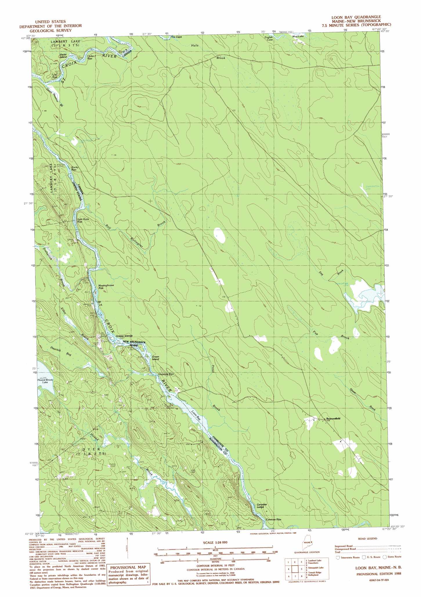
Loon Bay Topo Map Maine
To zoom in, hover over the map of Loon Bay
USGS Topo Quad 45067d4 - 1:24,000 scale
| Topo Map Name: | Loon Bay |
| USGS Topo Quad ID: | 45067d4 |
| Print Size: | ca. 21 1/4" wide x 27" high |
| Southeast Coordinates: | 45.375° N latitude / 67.375° W longitude |
| Map Center Coordinates: | 45.4375° N latitude / 67.4375° W longitude |
| U.S. State: | ME |
| Filename: | o45067d4.jpg |
| Download Map JPG Image: | Loon Bay topo map 1:24,000 scale |
| Map Type: | Topographic |
| Topo Series: | 7.5´ |
| Map Scale: | 1:24,000 |
| Source of Map Images: | United States Geological Survey (USGS) |
| Alternate Map Versions: |
Loon Bay ME 1988, updated 1988 Download PDF Buy paper map Loon Bay ME 2011 Download PDF Buy paper map Loon Bay ME 2014 Download PDF Buy paper map |
1:24,000 Topo Quads surrounding Loon Bay
Forest City |
||||
Forest |
Lambert Lake |
Vanceboro |
||
Tomah Mountain |
Simsquish Lake |
Loon Bay |
||
Waite |
Toman Ridge |
Kellyland |
||
Big Lake |
Princeton |
Woodland |
Calais |
Devils Head |
> Back to 45067a1 at 1:100,000 scale
> Back to 45066a1 at 1:250,000 scale
> Back to U.S. Topo Maps home
Loon Bay topo map: Gazetteer
Loon Bay: Bays
Loon Bay elevation 71m 232′Loon Bay: Capes
The Cape elevation 104m 341′Loon Bay: Islands
Cedar Island elevation 90m 295′Grassy Islands elevation 73m 239′
Loon Bay: Rapids
Canoose Rips elevation 73m 239′Cedar Island Rips elevation 88m 288′
Haycock Rips elevation 73m 239′
Meetinghouse Rips elevation 73m 239′
Rocky Rips elevation 80m 262′
Split Rock Rips elevation 76m 249′
Tyler Rips elevation 91m 298′
Loon Bay: Streams
Ellen Brook elevation 73m 239′Simsquish Brook elevation 76m 249′
Loon Bay: Swamps
Haycock Bog elevation 91m 298′Loon Bay digital topo map on disk
Buy this Loon Bay topo map showing relief, roads, GPS coordinates and other geographical features, as a high-resolution digital map file on DVD:
Maine, New Hampshire, Rhode Island & Eastern Massachusetts
Buy digital topo maps: Maine, New Hampshire, Rhode Island & Eastern Massachusetts