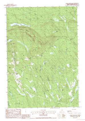
Tomah Mountain Topo Map Maine
To zoom in, hover over the map of Tomah Mountain
USGS Topo Quad 45067d6 - 1:24,000 scale
| Topo Map Name: | Tomah Mountain |
| USGS Topo Quad ID: | 45067d6 |
| Print Size: | ca. 21 1/4" wide x 27" high |
| Southeast Coordinates: | 45.375° N latitude / 67.625° W longitude |
| Map Center Coordinates: | 45.4375° N latitude / 67.6875° W longitude |
| U.S. State: | ME |
| Filename: | o45067d6.jpg |
| Download Map JPG Image: | Tomah Mountain topo map 1:24,000 scale |
| Map Type: | Topographic |
| Topo Series: | 7.5´ |
| Map Scale: | 1:24,000 |
| Source of Map Images: | United States Geological Survey (USGS) |
| Alternate Map Versions: |
Tomah Mountain ME 1988, updated 1988 Download PDF Buy paper map Tomah Mountain ME 2011 Download PDF Buy paper map Tomah Mountain ME 2014 Download PDF Buy paper map |
1:24,000 Topo Quads surrounding Tomah Mountain
> Back to 45067a1 at 1:100,000 scale
> Back to 45066a1 at 1:250,000 scale
> Back to U.S. Topo Maps home
Tomah Mountain topo map: Gazetteer
Tomah Mountain: Cliffs
The High Bluffs elevation 90m 295′Tomah Mountain: Lakes
Butcher Lake elevation 150m 492′Little Tomah Lake elevation 149m 488′
Simon Pond elevation 116m 380′
Unknown Pond elevation 90m 295′
Tomah Mountain: Populated Places
Codyville elevation 169m 554′Topsfield elevation 148m 485′
Tomah Mountain: Ridges
Hunt Ridge elevation 220m 721′Kane Ridge elevation 238m 780′
Tomah Mountain: Streams
Barter Brook elevation 109m 357′Deadman Stream elevation 107m 351′
Hill Brook elevation 84m 275′
Lindsey Brook elevation 98m 321′
Taylor Brook elevation 97m 318′
Tomah Mountain: Summits
Loring Hill elevation 219m 718′Tomah Mountain elevation 320m 1049′
Tomah Mountain: Swamps
Lathrop Heath elevation 118m 387′Malcome Bog elevation 167m 547′
Tomah Mountain digital topo map on disk
Buy this Tomah Mountain topo map showing relief, roads, GPS coordinates and other geographical features, as a high-resolution digital map file on DVD:
Maine, New Hampshire, Rhode Island & Eastern Massachusetts
Buy digital topo maps: Maine, New Hampshire, Rhode Island & Eastern Massachusetts


