Lambert Lake Topo Map Maine
To zoom in, hover over the map of Lambert Lake
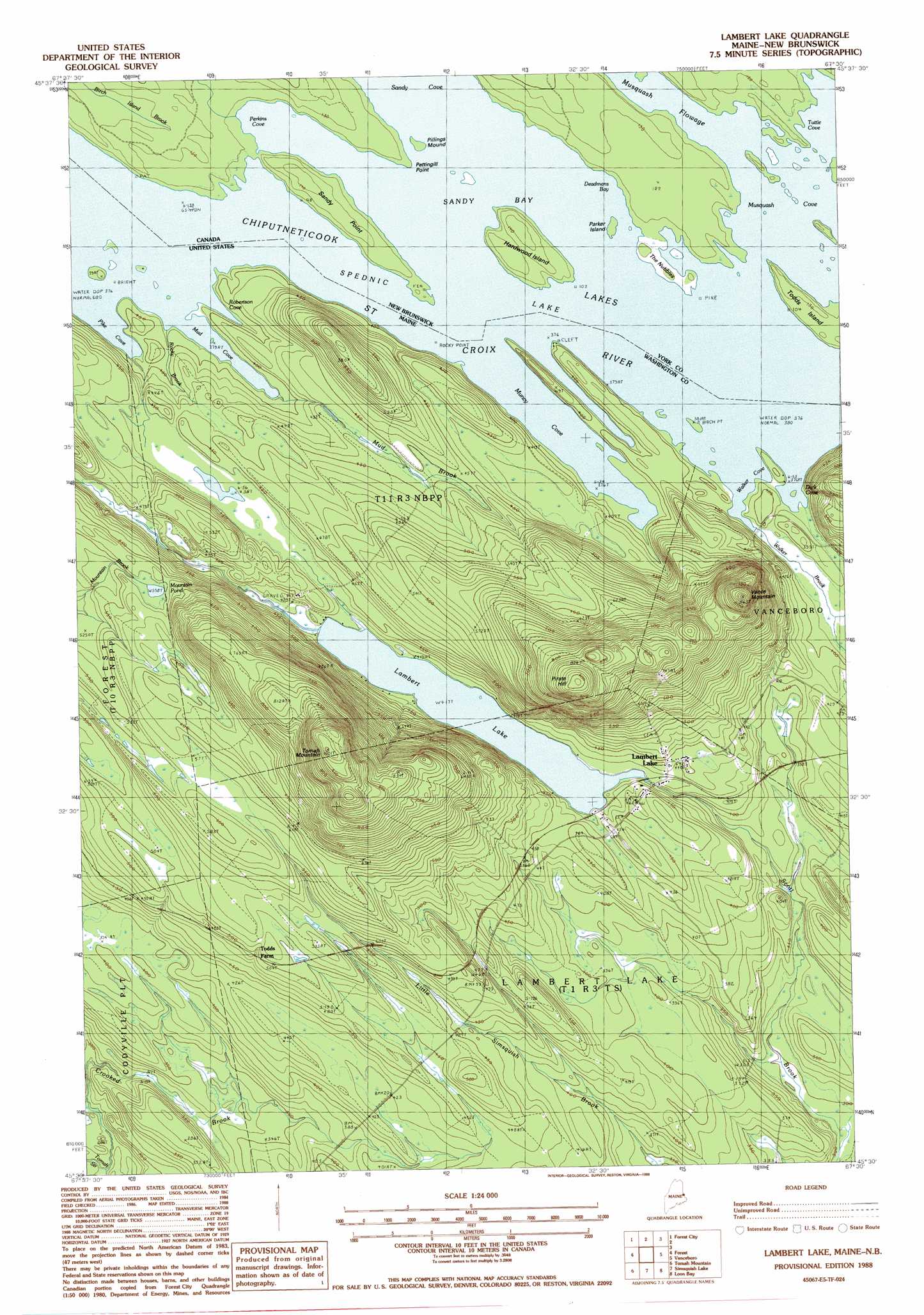
USGS Topo Quad 45067e5 - 1:24,000 scale
| Topo Map Name: | Lambert Lake |
| USGS Topo Quad ID: | 45067e5 |
| Print Size: | ca. 21 1/4" wide x 27" high |
| Southeast Coordinates: | 45.5° N latitude / 67.5° W longitude |
| Map Center Coordinates: | 45.5625° N latitude / 67.5625° W longitude |
| U.S. State: | ME |
| Filename: | o45067e5.jpg |
| Download Map JPG Image: | Lambert Lake topo map 1:24,000 scale |
| Map Type: | Topographic |
| Topo Series: | 7.5´ |
| Map Scale: | 1:24,000 |
| Source of Map Images: | United States Geological Survey (USGS) |
| Alternate Map Versions: |
Lambert Lake ME 1988, updated 1988 Download PDF Buy paper map Lambert Lake ME 2011 Download PDF Buy paper map Lambert Lake ME 2014 Download PDF Buy paper map |
1:24,000 Topo Quads surrounding Lambert Lake
Orient |
||||
Danforth |
Forest City |
|||
Brookton |
Forest |
Lambert Lake |
Vanceboro |
|
Farrow Mountain |
Tomah Mountain |
Simsquish Lake |
Loon Bay |
|
Oxbrook Lakes |
Waite |
Toman Ridge |
Kellyland |
> Back to 45067e1 at 1:100,000 scale
> Back to 45066a1 at 1:250,000 scale
> Back to U.S. Topo Maps home
Lambert Lake topo map: Gazetteer
Lambert Lake: Bays
Dark Cove elevation 116m 380′Mud Cove elevation 116m 380′
Muncy Cove elevation 116m 380′
Pike Cove elevation 119m 390′
Robertson Cove elevation 119m 390′
Walker Cove elevation 116m 380′
Lambert Lake: Lakes
Lambert Lake elevation 127m 416′Mountain Pond elevation 170m 557′
Lambert Lake: Populated Places
Lambert Lake elevation 134m 439′Lambert Lake: Streams
Crooked Brook elevation 85m 278′Mud Brook elevation 120m 393′
Rocky Brook elevation 116m 380′
Walker Brook elevation 118m 387′
Lambert Lake: Summits
Pirate Hill elevation 261m 856′Tomah Mountain elevation 295m 967′
Vance Mountain elevation 256m 839′
Lambert Lake digital topo map on disk
Buy this Lambert Lake topo map showing relief, roads, GPS coordinates and other geographical features, as a high-resolution digital map file on DVD:
Maine, New Hampshire, Rhode Island & Eastern Massachusetts
Buy digital topo maps: Maine, New Hampshire, Rhode Island & Eastern Massachusetts