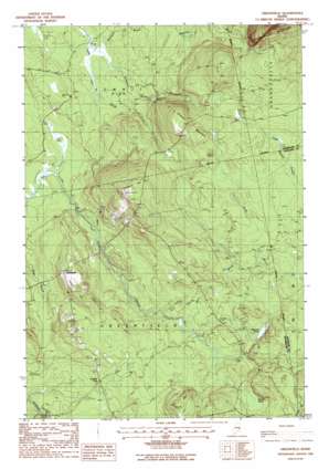
Greenfield Topo Map Maine
To zoom in, hover over the map of Greenfield
USGS Topo Quad 45068a4 - 1:24,000 scale
| Topo Map Name: | Greenfield |
| USGS Topo Quad ID: | 45068a4 |
| Print Size: | ca. 21 1/4" wide x 27" high |
| Southeast Coordinates: | 45° N latitude / 68.375° W longitude |
| Map Center Coordinates: | 45.0625° N latitude / 68.4375° W longitude |
| U.S. State: | ME |
| Filename: | o45068a4.jpg |
| Download Map JPG Image: | Greenfield topo map 1:24,000 scale |
| Map Type: | Topographic |
| Topo Series: | 7.5´ |
| Map Scale: | 1:24,000 |
| Source of Map Images: | United States Geological Survey (USGS) |
| Alternate Map Versions: |
Saponac SW ME 1975, updated 1980 Download PDF Buy paper map Greenfield ME 1988, updated 1988 Download PDF Buy paper map Greenfield ME 2011 Download PDF Buy paper map Greenfield ME 2014 Download PDF Buy paper map |
1:24,000 Topo Quads surrounding Greenfield
> Back to 45068a1 at 1:100,000 scale
> Back to 45068a1 at 1:250,000 scale
> Back to U.S. Topo Maps home
Greenfield topo map: Gazetteer
Greenfield: Lakes
Olamon Pond elevation 89m 291′Skunk Pond elevation 114m 374′
Greenfield: Populated Places
Crocker Turn elevation 79m 259′Greenfield elevation 125m 410′
Greenfield: Streams
Avery Brook elevation 79m 259′Hodgeson Brook elevation 47m 154′
Ledge Brook elevation 45m 147′
Mountain Brook elevation 73m 239′
North Branch Olamon Stream elevation 90m 295′
Stony Brook elevation 44m 144′
Greenfield: Summits
Cemetery Hill elevation 210m 688′Hall Hill elevation 152m 498′
Lambs Hill elevation 151m 495′
Summit Mountain elevation 194m 636′
Greenfield digital topo map on disk
Buy this Greenfield topo map showing relief, roads, GPS coordinates and other geographical features, as a high-resolution digital map file on DVD:
Maine, New Hampshire, Rhode Island & Eastern Massachusetts
Buy digital topo maps: Maine, New Hampshire, Rhode Island & Eastern Massachusetts


