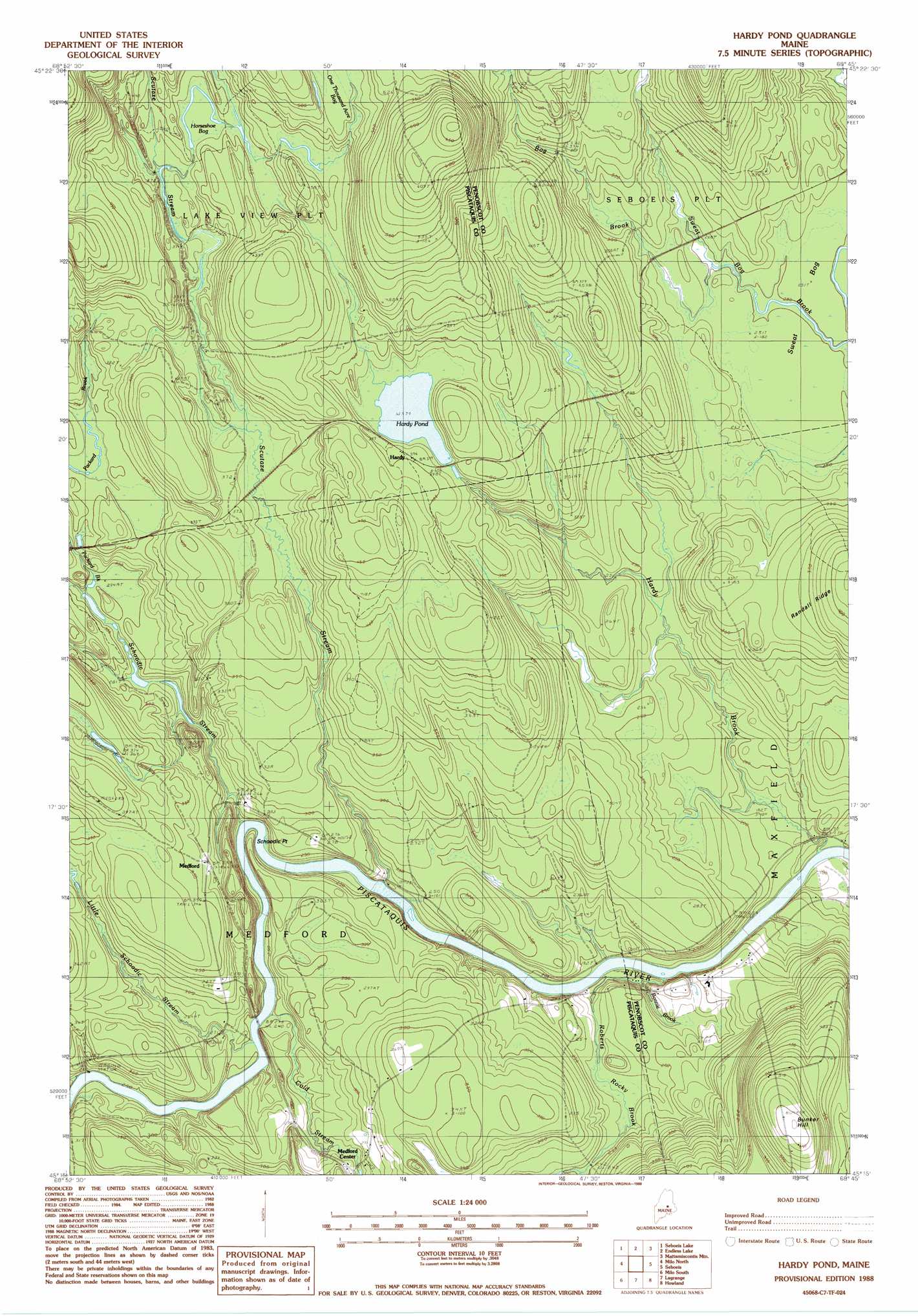
Hardy Pond Topo Map Maine
To zoom in, hover over the map of Hardy Pond
USGS Topo Quad 45068c7 - 1:24,000 scale
| Topo Map Name: | Hardy Pond |
| USGS Topo Quad ID: | 45068c7 |
| Print Size: | ca. 21 1/4" wide x 27" high |
| Southeast Coordinates: | 45.25° N latitude / 68.75° W longitude |
| Map Center Coordinates: | 45.3125° N latitude / 68.8125° W longitude |
| U.S. State: | ME |
| Filename: | o45068c7.jpg |
| Download Map JPG Image: | Hardy Pond topo map 1:24,000 scale |
| Map Type: | Topographic |
| Topo Series: | 7.5´ |
| Map Scale: | 1:24,000 |
| Source of Map Images: | United States Geological Survey (USGS) |
| Alternate Map Versions: |
Hardy Pond ME 1978, updated 1981 Download PDF Buy paper map Hardy Pond ME 1988, updated 1988 Download PDF Buy paper map Hardy Pond ME 2011 Download PDF Buy paper map Hardy Pond ME 2014 Download PDF Buy paper map |
1:24,000 Topo Quads surrounding Hardy Pond
Jo-Mary Mountain |
Ragged Mountain |
Cedar Lake |
Nollesemic Lake |
Medunkeunk Lake |
Ebeemee Mountain |
Seboeis Lake |
Endless Lake |
Mattamiscontis Mountain |
Nine Meadow Ridge |
Brownville Junction |
Milo North |
Hardy Pond |
Seboeis |
Lincoln West |
South Sebec |
Milo South |
Lagrange |
Howland |
Passadumkeag |
Charleston |
Bradford |
South Lagrange |
Greenbush |
Olamon |
> Back to 45068a1 at 1:100,000 scale
> Back to 45068a1 at 1:250,000 scale
> Back to U.S. Topo Maps home
Hardy Pond topo map: Gazetteer
Hardy Pond: Lakes
Hardy Pond elevation 115m 377′Hardy Pond: Populated Places
Hardy elevation 121m 396′Medford elevation 99m 324′
Hardy Pond: Streams
Bog Brook elevation 79m 259′Bonnie Brook elevation 56m 183′
Cold Stream elevation 74m 242′
Hardy Brook elevation 49m 160′
Little Schoodic Stream elevation 74m 242′
Meadow Brook elevation 73m 239′
Packard Brook elevation 101m 331′
Roberts Rocky Brook elevation 57m 187′
Schoodic Stream elevation 67m 219′
Scutaze Stream elevation 61m 200′
Hardy Pond: Summits
Bunker Hill elevation 169m 554′Hardy Pond: Swamps
Horseshoe Bog elevation 118m 387′Sweat Bog elevation 77m 252′
Hardy Pond: Trails
Hardy Pond Trail elevation 127m 416′Scutaze Trail elevation 110m 360′
Hardy Pond digital topo map on disk
Buy this Hardy Pond topo map showing relief, roads, GPS coordinates and other geographical features, as a high-resolution digital map file on DVD:
Maine, New Hampshire, Rhode Island & Eastern Massachusetts
Buy digital topo maps: Maine, New Hampshire, Rhode Island & Eastern Massachusetts