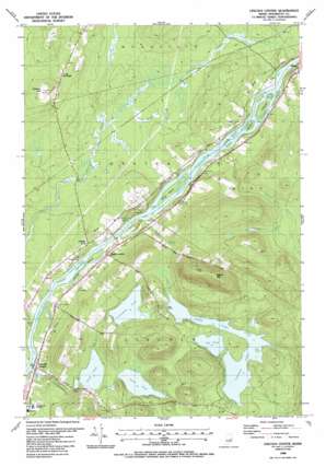
Lincoln Center Topo Map Maine
To zoom in, hover over the map of Lincoln Center
USGS Topo Quad 45068d4 - 1:24,000 scale
| Topo Map Name: | Lincoln Center |
| USGS Topo Quad ID: | 45068d4 |
| Print Size: | ca. 21 1/4" wide x 27" high |
| Southeast Coordinates: | 45.375° N latitude / 68.375° W longitude |
| Map Center Coordinates: | 45.4375° N latitude / 68.4375° W longitude |
| U.S. State: | ME |
| Filename: | o45068d4.jpg |
| Download Map JPG Image: | Lincoln Center topo map 1:24,000 scale |
| Map Type: | Topographic |
| Topo Series: | 7.5´ |
| Map Scale: | 1:24,000 |
| Source of Map Images: | United States Geological Survey (USGS) |
| Alternate Map Versions: |
Winn NW ME 1975, updated 1980 Download PDF Buy paper map Lincoln Center ME 1988, updated 1988 Download PDF Buy paper map Lincoln Center ME 2011 Download PDF Buy paper map Lincoln Center ME 2014 Download PDF Buy paper map |
1:24,000 Topo Quads surrounding Lincoln Center
> Back to 45068a1 at 1:100,000 scale
> Back to 45068a1 at 1:250,000 scale
> Back to U.S. Topo Maps home
Lincoln Center topo map: Gazetteer
Lincoln Center: Dams
Long Pond Dam elevation 91m 298′Mill Pond Dam elevation 55m 180′
Snag Pond Dam elevation 74m 242′
Lincoln Center: Islands
Brown Islands elevation 53m 173′Hersey Island elevation 50m 164′
Snow Island elevation 52m 170′
Lincoln Center: Lakes
Cambolasse Pond elevation 87m 285′Caribou Pond elevation 94m 308′
Center Pond elevation 82m 269′
Egg Pond elevation 94m 308′
Lincoln Center: Populated Places
Chester elevation 67m 219′Lincoln Center elevation 74m 242′
North Lincoln elevation 63m 206′
South Woodville elevation 109m 357′
Lincoln Center: Rapids
Sebonibus Rapids elevation 52m 170′Lincoln Center: Reservoirs
Cambolasse Stream Reservoir elevation 55m 180′Long Pond elevation 94m 308′
Stump Pond elevation 74m 242′
Lincoln Center: Streams
Blood Brook elevation 66m 216′Cambolasse Stream elevation 51m 167′
Flowers Brook elevation 95m 311′
Salmon Stream elevation 53m 173′
Smith Brook elevation 52m 170′
Tobin Brook elevation 95m 311′
Lincoln Center: Summits
Bagley Mountain elevation 269m 882′Glidden Hill elevation 145m 475′
Lincoln Center digital topo map on disk
Buy this Lincoln Center topo map showing relief, roads, GPS coordinates and other geographical features, as a high-resolution digital map file on DVD:
Maine, New Hampshire, Rhode Island & Eastern Massachusetts
Buy digital topo maps: Maine, New Hampshire, Rhode Island & Eastern Massachusetts


