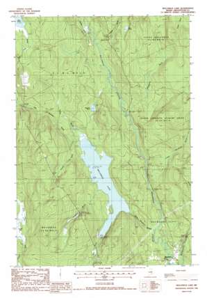
Molunkid Lake Topo Map Maine
To zoom in, hover over the map of Molunkid Lake
USGS Topo Quad 45068f3 - 1:24,000 scale
| Topo Map Name: | Molunkid Lake |
| USGS Topo Quad ID: | 45068f3 |
| Print Size: | ca. 21 1/4" wide x 27" high |
| Southeast Coordinates: | 45.625° N latitude / 68.25° W longitude |
| Map Center Coordinates: | 45.6875° N latitude / 68.3125° W longitude |
| U.S. State: | ME |
| Filename: | o45068f3.jpg |
| Download Map JPG Image: | Molunkid Lake topo map 1:24,000 scale |
| Map Type: | Topographic |
| Topo Series: | 7.5´ |
| Map Scale: | 1:24,000 |
| Source of Map Images: | United States Geological Survey (USGS) |
| Alternate Map Versions: |
Mattawamkeag NE ME 1975, updated 1980 Download PDF Buy paper map Molunkus Lake ME 1988, updated 1988 Download PDF Buy paper map Molunkus Lake ME 2011 Download PDF Buy paper map Molunkus Lake ME 2014 Download PDF Buy paper map |
1:24,000 Topo Quads surrounding Molunkid Lake
> Back to 45068e1 at 1:100,000 scale
> Back to 45068a1 at 1:250,000 scale
> Back to U.S. Topo Maps home
Molunkid Lake topo map: Gazetteer
Molunkid Lake: Lakes
Haywire Pond elevation 114m 374′Lost Pond elevation 141m 462′
Molunkus Lake elevation 108m 354′
Molunkid Lake: Populated Places
Macwahoc elevation 97m 318′Molunkid Lake: Streams
Baker Brook elevation 108m 354′Fourmile Brook elevation 108m 354′
Fowler Brook elevation 109m 357′
Gulliver Brook elevation 110m 360′
Henderson Brook elevation 107m 351′
Little Molunkus Stream elevation 94m 308′
Lower Henderson Brook elevation 105m 344′
Macwahoc Stream elevation 92m 301′
Plunkett Brook elevation 110m 360′
Threemile Brook elevation 108m 354′
Molunkid Lake: Swamps
Carlton Bog elevation 119m 390′Molunkid Lake: Trails
Pine Tree Trail elevation 99m 324′Molunkid Lake digital topo map on disk
Buy this Molunkid Lake topo map showing relief, roads, GPS coordinates and other geographical features, as a high-resolution digital map file on DVD:
Maine, New Hampshire, Rhode Island & Eastern Massachusetts
Buy digital topo maps: Maine, New Hampshire, Rhode Island & Eastern Massachusetts


